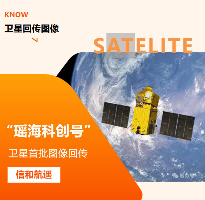
Powered by YaoHai KeChuang Satellite | Xinhe Aerial Remote Sensing Information Technology (Anhui) Co., Ltd.
Abstract
Commercial satellite imagery refers to high-precision remote sensing data captured and operated by commercial aerospace entities, designed for civilian, industrial and scientific research scenarios. Compared with free public satellite data, commercial remote sensing imagery features higher spatial resolution, flexible on-demand tasking, clear authorization and professional technical support. Our self-operated YaoHai KeChuang Satellite can reach 0.5m spatial resolution, and we mainly promote 0.5m and sub-meter high-resolution satellite imagery products. All our cross-border data services strictly abide by relevant Chinese laws and regulations on remote sensing data management, cross-border data transfer and export control, and are only provided for legal civilian and commercial purposes. The products have become a core data infrastructure for agriculture, environmental protection, natural resource management, infrastructure supervision and disaster response worldwide.
This guide explains the basic definition, core types, key technical parameters and mainstream industry applications of commercial satellite imagery. It also introduces the self-operated YaoHai KeChuang Satellite of Xinhe Remote Sensing, as well as our integrated space-ground remote sensing solutions combining satellite, UAV and digital twin technologies and full-process compliance guarantee system, to help global beginners and project decision-makers quickly select suitable and compliant satellite data services.
1. What Exactly Is Commercial Satellite Imagery?
Commercial satellite imagery is earth observation data collected by commercially funded and operated remote sensing satellites, which is provided to enterprises, government agencies, research institutions and engineering teams through paid licensing or customized services in strict accordance with relevant national regulations.
Different from public welfare satellite data (such as Sentinel and Landsat) released by government agencies for free, commercial satellite remote sensing focuses on higher data accuracy, more flexible shooting scheduling, full-cycle technical services and standardized compliance management, and all data and services are strictly limited to civilian and commercial scenarios to ensure compliance with laws and regulations.
Core characteristics of commercial satellite imagery
· Higher resolution: It can achieve sub-meter to meter-level ground observation. Our flagship 0.5m high-resolution product can clearly identify ground objects, facilities and subtle changes, meeting the demand for fine supervision;
· On-demand tasking: Users can designate eligible regions and time windows for custom shooting to meet the needs of phased projects, and the whole process is managed in accordance with compliance requirements;
· Clear and compliant authorization: Standard commercial use, research use and redistribution authorization are provided, with clear scope of data use rights and full compliance with cross-border data management regulations;
· Value-added services: It supports radiometric correction, orthorectification, image mosaicking, index calculation and interpretation analysis, and can be directly used for project delivery;
· Traceable compliance: The whole process from data acquisition, processing to delivery is traceable, strictly abides by national remote sensing data export management regulations, and ensures the legality and stability of data use by customers.
2. Main Types of Commercial Satellite Remote Sensing Data
According to imaging principles and application scenarios, mainstream commercial satellite data can be divided into four categories, which can be selected and combined according to project requirements and compliance conditions:
2.1 High-Resolution Optical Satellite Imagery
Optical satellite imagery captures reflected light signals from the ground surface, with intuitive visual effects and rich texture details, and is the most widely used type of commercial remote sensing data.
· Typical resolution: 0.5m sub-meter to 5m meter-level high definition;
· Core applications: Land survey, engineering progress supervision, urban planning, fine ground object identification;
Our core advantage: The self-operated YaoHai KeChuang Satellite can reach 0.5m spatial resolution. We focus on promoting 0.5m and sub-meter high-resolution optical image products, and provide stable, high-precision and compliant data services for global clients in accordance with national regulations.
2.2 InSAR (Interferometric Synthetic Aperture Radar) Data
InSAR technology uses microwave signals for imaging, which can penetrate cloud and fog and work all day and all weather, and is mainly used for micro-deformation monitoring of the ground surface.
· Core advantages: Not affected by light and weather conditions, and can realize millimeter-level deformation detection;
· Core applications: Dam safety monitoring, mining area subsidence detection, railway and pipeline deformation early warning, geological disaster monitoring.
2.3 Multispectral Remote Sensing Data
Multispectral data covers multiple bands such as visible light and near-infrared, and can extract vegetation, water body and soil information through spectral index calculation, which is the core data source for industry monitoring. Our 0.5m panchromatic + multispectral fusion products can simultaneously meet the dual needs of high-precision visual interpretation and spectral index analysis, and all products are delivered in compliance with regulations.
· Common indexes: NDVI (vegetation index), NDWI (water body index), land cover classification;
· Core applications: Crop growth monitoring, water environment investigation, ecological change detection, forest resource statistics.
2.4 Infrared Remote Sensing Data
Infrared band imaging can capture temperature and thermal radiation characteristics of ground objects, and is used for specific civilian scenarios such as thermal anomaly identification.
· Core applications: Straw burning monitoring, wildfire identification, industrial heat emission detection, black and odorous water body screening.
3. Core Technical Parameters to Understand
For beginners, the following five parameters directly determine the applicability and cost of satellite imagery, and are also the primary reference indicators for selecting data. The provision of all resolution products needs to meet national compliance requirements:
|
Parameter |
Definition |
Reference Value for Commercial Scenarios |
|
Spatial Resolution |
The size of the smallest ground object that can be identified by the image |
0.5m sub-meter resolution is the first choice for fine supervision (subject to compliance approval); 1m–2m for conventional precision projects; 5m–10m for large-area regional monitoring |
|
Revisit Cycle |
Time interval for the satellite to observe the same area again |
1–3 days for high-frequency dynamic monitoring; 5–15 days for periodic survey |
|
Spectral Band |
Light wave range captured by the sensor |
Visible light + near-infrared for conventional agriculture and environmental protection; increased short-wave infrared for mineral and geological scenes |
|
Imaging Swath |
Width of single imaging coverage |
Large swath improves efficiency for large-area monitoring; small swath is more flexible for fragmented plots |
|
Product Level |
Processing level of original data |
Orthorectified products (L3) can be used directly; original data (L1) is suitable for secondary development (subject to compliance regulations) |
4. Top Commercial Applications of Satellite Imagery
With the reduction of commercial satellite application costs, remote sensing data has become a standard management tool in multiple industries. Our 0.5m high-resolution satellite imagery can support more refined supervision scenarios, and all are only used for legal civilian and commercial fields. The following are the most mature application directions at present:
4.1 Agriculture & Rural Development
· Crop growth monitoring and yield estimation based on multispectral indexes, with 0.5m resolution supporting fine plot-level analysis;
· Remote sensing supervision of high-standard farmland construction and cultivated land protection, accurately identifying non-agricultural and non-grain conversion patches;
· Rapid damage assessment and claim settlement support for agricultural insurance;
· Planting structure statistics and industrial layout analysis.
4.2 Ecological & Environmental Protection
· Identification and dynamic monitoring of black and odorous water bodies;
· Remote sensing inspection of "four illicit activities" (illegal mining, occupation, stockpiling and construction) in rivers and lakes;
· Monitoring of straw open burning and bare soil dust sources;
· Ecological change survey for national garden city creation.
4.3 Natural Resource Management
· Monitoring of non-agricultural and non-grain conversion of cultivated land, with 0.5m high resolution effectively identifying small illegal patches;
· Dynamic supervision of mine resource development and vegetation restoration;
· Inspection of illegal land occupation and unapproved construction;
· Land use change survey and annual update statistics.
4.4 Forestry & Wetland Conservation
· Dynamic change monitoring of forest, grassland and wetland resources;
· General survey and inventory statistics of forestry resources;
· Remote sensing monitoring and early warning of pine wood nematode disease;
· Post-fire forest damage assessment and desertification monitoring.
4.5 Energy & Infrastructure Supervision
· Photovoltaic power station operation status and surrounding vegetation shielding inspection;
· Hidden danger inspection of high-voltage transmission line corridors;
· Remote sensing progress supervision of large engineering projects, with sub-meter resolution clearly presenting construction details;
· Regular monitoring of pipeline and transportation infrastructure.
4.6 Emergency Management & Disaster Response
· Rapid mapping and inundation range assessment for flood disasters;
· Post-earthquake damage investigation and emergency command support;
· Forest fire spread tracking and post-disaster loss statistics;
· Emergency material scheduling and on-site situation analysis.
5. Commercial Satellite Data vs. Free Public Satellite Data: What’s the Difference?
Many beginners will ask: Since there are free satellite data such as Sentinel and Landsat, why choose commercial satellite imagery? The core differences lie in accuracy, flexibility, service support and compliance guarantee. Our 0.5m high-resolution products have obvious advantages in fine supervision scenarios, and the whole process is standardized and compliant:
|
Dimension |
Free Public Satellite Data |
Commercial Satellite Imagery |
|
Spatial Resolution |
Mostly 10m–30m, only suitable for macroscopic analysis |
0.5m–5m high resolution, with 0.5m sub-meter product as our flagship offering, supporting fine identification and supervision |
|
Shooting Flexibility |
Fixed shooting plan, unable to customize according to project demand |
Support on-demand tasking for eligible regions, and priority shooting can be arranged for emergency scenarios under compliance requirements |
|
Revisit Efficiency |
Long revisit cycle, easy to be affected by cloud cover and miss key time nodes |
Multi-satellite constellation scheduling, shorter revisit cycle and higher data acquisition success rate |
|
Authorization & Compliance |
No clear commercial authorization, no compliance guarantee for cross-border use, and no liability subject for data problems |
Standard commercial license, clear scope of use, full compliance with cross-border data export regulations, and full technical support |
|
Value-added Service |
Only original data is provided, requiring independent processing |
Provides correction, mosaicking, index calculation, interpretation analysis and other full-process services |
|
Suitable Scenarios |
Scientific research learning, macroscopic trend analysis, low-precision preliminary research |
Commercial project delivery, law enforcement supervision, fine management, emergency response (all for civilian use) |
6. Our YaoHai KeChuang Satellite: Custom Commercial Remote Sensing Solutions
As a comprehensive remote sensing service provider with self-operated commercial satellite YaoHai KeChuang, Xinhe Aerial Remote Sensing Information Technology (Anhui) Co., Ltd. provides global customers with one-stop commercial satellite remote sensing services covering data acquisition, processing and industrial landing. We focus on 0.5m and sub-meter high-resolution satellite imagery, strictly abide by national remote sensing data management and export control regulations, and are committed to delivering high-precision, high-stability and fully compliant remote sensing data products for global clients.
6.1 Self-Operated Satellite, Flexible & Efficient Tasking Under Compliance Framework
Relying on the YaoHai KeChuang satellite constellation with 0.5m spatial resolution, we support custom satellite tasking and archive data retrieval for eligible regions around the world. Compared with third-party agency services, direct operation of satellites ensures shorter delivery cycle, more flexible shooting priority arrangement under compliance requirements, and more stable data quality and supply.
6.2 Full-Stack Data Production & Value-Added Services
We do not only provide original 0.5m high-resolution image data that meet export regulations, but also have a professional data processing team to deliver directly usable remote sensing products:
· Standard products: 0.5m orthorectified imagery, digital elevation model (DEM), panchromatic + multispectral fusion products;
· Value-added products: Image mosaicking, index calculation, change detection, thematic map making, interpretation analysis;
· Platform services: Integrated supervision platform for multiple industries, supporting data visualization and full-process management.
6.3 Integrated Space-Ground Solution
Different from single data suppliers, we have formed a full-dimensional service system of "satellite remote sensing + low-altitude UAV + digital twin platform":
· Satellite: Large-area periodic dynamic monitoring with 0.5m high resolution;
· UAV: High-precision supplementary shooting for key areas and emergency scenes;
· Digital twin: 3D scene construction, data visualization and intelligent management platform.
This integrated solution is widely used in smart agriculture, ecological environmental protection, smart park, construction site supervision and other fields, helping customers realize full-cycle digital management from data acquisition to decision-making application.
6.4 Full-Process Compliance Guarantee
All cross-border data services of our company strictly follow the relevant laws and regulations of the People's Republic of China on remote sensing data management, cross-border data security and export control, and establish a complete compliance management system:
1.Qualification guarantee: We have complete remote sensing data service and operation qualifications, and carry out cross-border business in accordance with laws and regulations;
2.Use review: Strictly review the customer's use scenario and purpose, and all data are only used for legal civilian and commercial fields;
3.Export compliance: Fulfill the corresponding data export approval procedures in accordance with the regulations for high-resolution data export to ensure the legality of cross-border data delivery;
4.Authorization management: Standardize the scope of data use, prohibit secondary distribution and use beyond the authorized scope, and protect data security;
5.Full-process traceability: The whole process from data acquisition, processing to delivery is recorded and traceable to ensure compliance and controllability.
7. Frequently Asked Questions (FAQ)
Q1: What is the highest resolution of commercial satellite imagery available?
At present, mainstream commercial optical satellites can provide up to 0.3m–0.5m high-resolution imagery, which can clearly identify ground facilities, buildings and fine land features. Our self-operated YaoHai KeChuang Satellite can reach 0.5m spatial resolution, and we mainly promote 0.5m and sub-meter high-resolution products. All cross-border provision of data is carried out in strict accordance with national regulations, which can meet most fine supervision needs of civilian and commercial scenarios.
Q2: Can I order custom satellite imagery for a specific location?
Yes. We support custom tasking of 0.5m high-resolution satellite imagery for regions that meet relevant compliance requirements around the world. You only need to provide the scope, expected time window, resolution requirements and relevant use certification materials. After we complete the compliance review, we will arrange satellite shooting and deliver the data according to the project schedule.
Q3: What licensing options are available for commercial satellite data?
We provide targeted licensing schemes for different types of customers and project scenarios. All data use scopes are clearly defined in strict accordance with cross-border data management regulations, and customized authorization schemes can be made according to your specific usage scenarios.
Q4: How long does it take to receive ordered satellite imagery?
· For archive data: 0.5m archive data can be delivered within 1–3 working days after order confirmation and compliance review;
· For new custom tasking: The conventional cycle is 5–15 working days (excluding compliance review time), and emergency green channel service is supported for disaster and emergency projects under the premise of meeting compliance requirements.
Q5: Can satellite imagery work normally in cloudy and rainy weather?
Optical satellite imagery will be affected by cloud cover. For areas with frequent cloudy and rainy weather or all-weather monitoring needs, we recommend matching SAR satellite data, or adopting a combined scheme of 0.5m optical + SAR to ensure data continuity and monitoring accuracy on the premise of compliance.
Q6: Is the cross-border provision of 0.5m high-resolution satellite imagery compliant?
All our cross-border satellite data services strictly abide by Chinese laws and regulations on remote sensing data management, cross-border data security and export control. We have a complete compliance review process, and will perform corresponding approval procedures in accordance with the regulations for high-resolution data export, to ensure that the whole process from data acquisition to delivery is legal and traceable, and protect the legitimate rights and interests of both parties.
Final Thoughts
Commercial satellite imagery has changed the traditional mode of ground investigation and manual inspection, and become an efficient, low-cost and large-coverage digital management tool. With the popularization of commercial satellite constellations, high-resolution remote sensing data represented by 0.5m sub-meter level will be deeply applied to more segmented civilian industries on the premise of standardized compliance.
As a service provider with self-operated YaoHai KeChuang Satellite and full-stack remote sensing delivery capability, Xinhe Remote Sensing focuses on 0.5m and sub-meter high-resolution satellite imagery, always takes compliance operation as the bottom line, and is committed to providing global customers with stable, compliant and cost-effective commercial satellite data and industry solutions.
If you need to purchase 0.5m high-resolution satellite imagery for your project, or want to learn more about application solutions for agriculture, environmental protection, natural resources and other industries, welcome to contact our team for a free technical consultation and customized quotation.
Xinhe Aerial Remote Sensing Information Technology (Anhui) Co., Ltd. | Global Commercial Remote Sensing Service Provider.