With the vigorous development of aviation industry, the safety of aircraft has attracted more and more attention.
The safety of airport clearance is of great significance, which seriously affects the take-off and landing of aircraft and flight, in order to ensure the safe take-off and landing of the aircraft and the normal use of the airport, according to the characteristics of the aircraft used in the airport, it is necessary to fully understand and accurately measure the position and elevation of the super high buildings or other obstacles in the airport and its vicinity, and draw the obstacle position map in the airport clearance area, compared with the restricted clearance surface of airport, it provides scientific basis for the treatment or demolition of structures threatening the safety of aircraft take-off and landing.
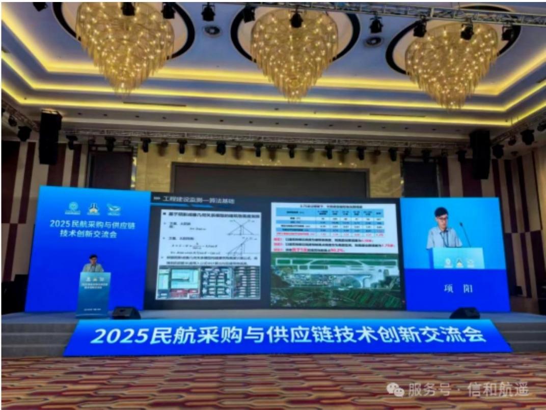
Our company executives attend the Civil Aviation Procurement Conference
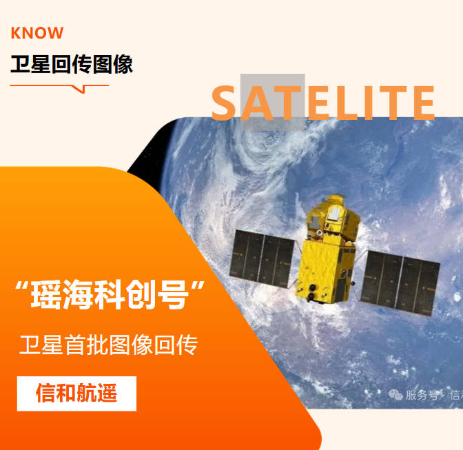
Traditional manual inspection in the face of this vast area, often appear powerless. Nowadays, many flying in space“Eye in the sky”-optical remote sensing satellites, with its unique perspective, is completely changing the pattern of clearance protection. Today, let's find out how these eyes work.
I. the challenge: the“Blind spot” of traditional clearance inspections
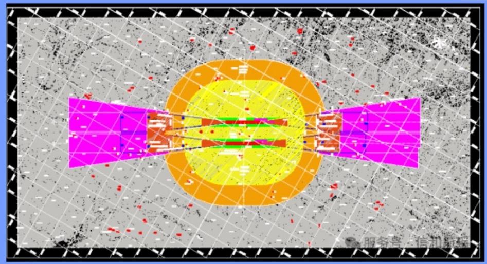
Plan of Airport Clearance Protection Area
The airport clearance area has a wide range and complex terrain, and there are various potential safety hazards:
Illegal Construction: new high-rise buildings built without approval.
Tall construction equipment: tower cranes and cranes on construction sites.
Quietly Tall Trees: natural or newly planted patches of trees.
Hard-to-detect accumulations: Mountains of rubbish, building material yards, etc. .
In the face of these, the traditional manual inspection is not only inefficient and long-term, but also limited to the ground perspective, which is easy to have visual blind spots, and it is difficult to quantify the changes that occur slowly.
II. EDGE tools: what are optical remote sensing satellites?
In short, an optical remote-sensing satellite is like a super-camera zooming through space. It images objects by capturing sunlight reflected off them, giving us high-resolution“Photos” of the Earth's surface.
The key measure of the camera's capabilities is its resolution, which includes:
Spatial resolution (“How well you can see”) : the actual size of the ground represented by the pixels. High-resolution satellite imagery means that satellites can identify objects the size of a suitcase on the ground from hundreds of kilometres up, making it easy to see the outlines of cranes and buildings.
Temporal resolution (“How often to look”) : refers to the frequency with which satellites revisit the same location. Our company can carry out high-frequency observation half a month or even once a week to ensure the timeliness of monitoring.
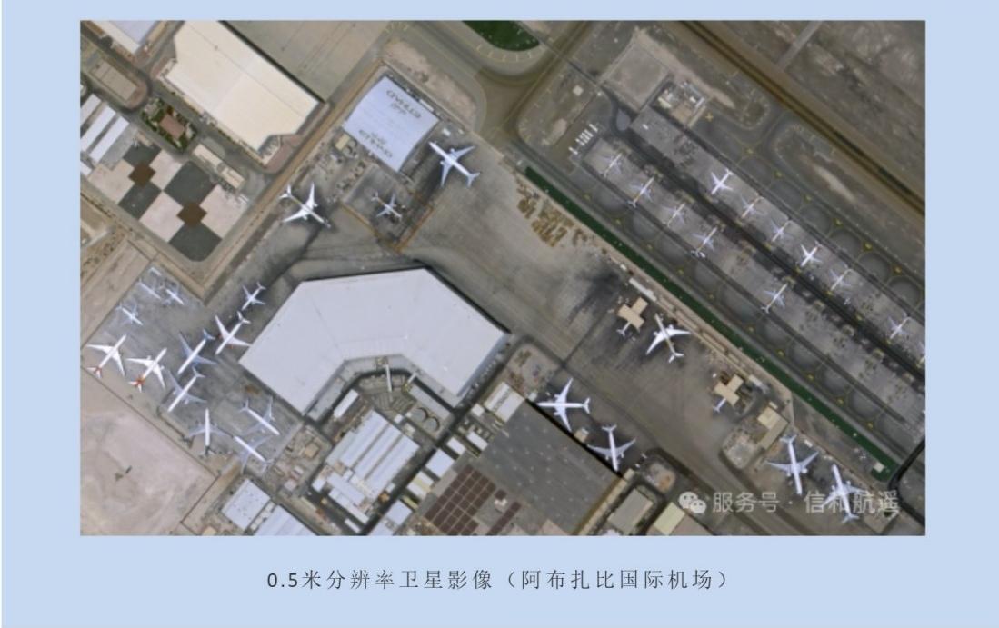
Ⅲ.Actual combat: four steps for optical satellites to patrol the clearance area
Here's how optical satellite technology goes from a“Picture” to an accurate“Patrol report”:
Step 1: “Take Pictures” on a regular basis and create a profile
Mobilize the optical satellite constellation, regularly (such as weekly or semi-monthly) on the target airport clearance protection area for full coverage of photography, to obtain the latest, the most clear satellite images.
Step 2: AI“Find the difference”, intelligent recognition
We use artificial intelligence AI image recognition algorithm to automatically compare the images of different periods.
Change Detection: algorithms can detect new buildings, construction sites, and mounds in protected areas as sensitively as a game of“Find the difference”.
Object Extraction: automatic identification and delineation of potential obstacles such as buildings, tower cranes and utility poles.
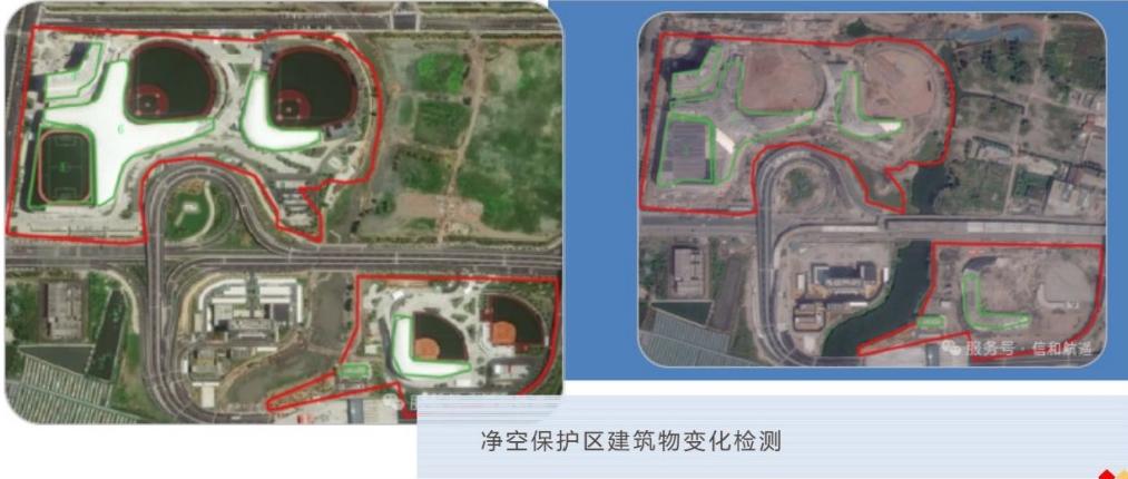
Step 3: three-dimensional“Measurement” to determine the superelevation
After obtaining the position and outline of the target, how do you know if it is superelevation?
Establish the obstacle limitation surface model:According to the civil aviation regulations, our company can accurately construct the airport clearance protection in the computer, three-dimensional security boundary of the zone (a complex virtual“Hood” consisting of multiple inclined planes) .
Elevation Assignment: a combination of stereopair measurement techniques and high-precision digital surface models (dsms) assign precise elevation information to each identified object (and can also be rechecked by building shadow calculations) .
Overlay comparison and automatic alarm: overlay the target with height with the 3D clearance limit surface model. The system automatically performs a collision analysis to quickly screen out any suspected superelevation that“Punctures” the safety boundary and generate a detailed list of its location, image, and height.
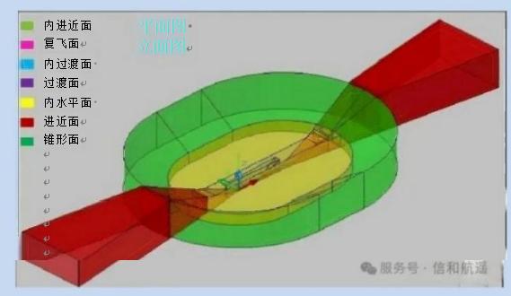
3D restricted surface model of airport clearance
Step 4: generating reports, accurate navigation
Finally, all the suspected hidden trouble points are marked out on the electronic map to form a“One map” type inspection report. Airport Management, management personnel can search according to the map, directly to the target point for accurate verification and disposal, greatly improving the efficiency of on-site work.
Ⅳ.Advantage: Why Choose Optical Remote Sensing Satellites?
At a glance, visual: high-definition images as the scene photos, the evidence is solid, easy to understand and communicate.
Efficiency is increased, saving time and effort: a transit can cover hundreds of square kilometers, replacing a large number of manual travel.
Objective and impartial, data-driven: image evidence, avoid human interference, accurate and reliable measurement results.
Proactive early warning: high-frequency monitoring can detect violations early on, shifting from“After-the-fact punishment” to“Before-the-fact intervention” to facilitate early treatment.
V. Looking ahead
With the increasing abundance of satellite data and the continuous evolution of AI algorithms, future clearance inspections will be more intelligent. We are committed to the realization of“Real-time perception-automatic identification-intelligent warning” fully automated closed-loop, for air traffic control safety to build an indestructible line of defense.