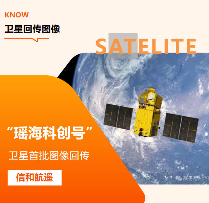
Powered by YaoHai KeChuang Satellite | Compliant Commercial Remote Sensing Solutions
Abstract
Spatial resolution is the most critical indicator when selecting commercial satellite imagery, as it directly determines recognition accuracy, coverage efficiency and project budget. Many buyers blindly pursue the highest resolution without matching actual demands, resulting in unnecessary cost waste, while insufficient resolution will fail to meet fine supervision requirements.
This guide systematically compares the core differences, applicable scenarios and selection logic of three mainstream commercial satellite imagery grades: 0.5m, 1m and 5m. It provides clear resolution recommendations for major industries including agriculture, ecological protection, natural resources and infrastructure, to help project decision-makers match the most cost-effective solution. We also introduce our self-operated YaoHai KeChuang 0.5m high-resolution satellite and our full-process compliant cross-border data delivery service.
1. What Is Spatial Resolution in Satellite Imagery?
Spatial resolution describes the physical size of ground area corresponding to a single pixel in a satellite image. For example, 0.5m resolution means each pixel represents a 0.5m × 0.5m square on the ground.
In principle:
·Higher resolution = finer ground details, smaller single-scene coverage, higher unit cost
·Lower resolution = larger single-scene coverage, lower cost, suitable for macroscopic regional analysis
For commercial projects, the optimal resolution is not the highest one, but the one that exactly matches project objectives, supervision granularity and budget.
2. Core Comparison: 0.5m vs 1m vs 5m Satellite Imagery
|
Comparison Item |
0.5m Sub-Meter Imagery |
1m High-Resolution Imagery |
5m Medium-Resolution Imagery |
|
Spatial Resolution |
0.5m per pixel (sub-meter level) |
1m per pixel (meter level) |
5m per pixel (medium level) |
|
Ground Recognition Capability |
Identifies vehicles, small buildings, field ridges, tiny ground features and fine structure details |
Identifies houses, roads, contiguous farmland, medium and large facilities and main ground object boundaries |
Identifies town outlines, large farmland patches, river trends and regional vegetation coverage |
|
Single-Scene Coverage Efficiency |
Small coverage range, suitable for key area monitoring |
Medium coverage, balances detail and efficiency |
Large coverage range, high efficiency for large-area census |
|
Relative Cost Level |
High |
Medium (most cost-effective) |
Low |
|
Archive Data Delivery Cycle |
1–3 working days (subject to compliance review) |
1–3 working days |
1–2 working days |
|
Best Project Types |
Fine supervision, law enforcement inspection, engineering-level mapping |
Conventional dynamic monitoring, industrial application, regional survey |
Macroscopic census, large-area change analysis, trend research |
3. Detailed Breakdown of Each Resolution Level
3.1 0.5m Sub-Meter High-Resolution Satellite Imagery
As the flagship grade of commercial optical satellite data, 0.5m imagery delivers the finest ground detail identification capability among civilian commercial products.
Core advantages
·Plot-level and facility-level fine identification
·Supports quantitative analysis of small patches
·Meets the accuracy requirements of supervision and law enforcement scenarios
·Can be used for high-precision mapping and engineering verification
Typical application scenarios
·Monitoring of non-agricultural and non-grain conversion of cultivated land
·Illegal construction and illegal land occupation inspection
·Construction progress supervision of large engineering projects
·Agricultural insurance loss assessment and fine plot analysis
·High-precision thematic mapping and urban fine management
Our advantage Our self-operated YaoHai KeChuang Satellite provides 0.5m panchromatic + multispectral fusion imagery. All cross-border delivery strictly complies with China's remote sensing data export regulations, and is only applicable to legal civilian and commercial projects, ensuring full traceability and compliance of data use.
Not suitable for
·Large-area provincial or national level census
·Long-term time-series monitoring with limited budget
3.2 1m High-Resolution Satellite Imagery
1m resolution is the most widely used grade in commercial remote sensing, balancing identification accuracy, coverage efficiency and procurement cost.
Core advantages
·Meets most conventional commercial supervision needs
·Cost-effective, with high cost performance
·Sufficient to identify main ground object types and boundaries
·Suitable for periodic dynamic monitoring
Typical application scenarios
·Conventional crop growth monitoring and yield estimation
·Regional ecological change survey and vegetation coverage statistics
·Daily supervision of mine resources and ecological restoration
·Urban expansion monitoring and land use change survey
·Routine inspection of long-distance infrastructure corridors
Not suitable for
·Ultra-fine law enforcement supervision that requires identification of tiny ground features
·High-precision engineering mapping projects
3.3 5m Medium-Resolution Satellite Imagery
5m resolution focuses on large-area and high-frequency monitoring, and is the first choice for macroscopic trend analysis and wide-range dynamic observation.
Core advantages
·Large single-scene coverage, high census efficiency
·Low unit area cost, suitable for long-term continuous monitoring
·Short revisit cycle, easy to form stable time-series data
·Low cloud cover risk, high data acquisition success rate
Typical application scenarios
·Provincial and national land resource census
·Large-area vegetation change and desertification monitoring
·Macroscopic assessment of disaster impact scope
·Regional agricultural planting structure statistics
·Long-term ecological environment trend analysis
Not suitable for
·Fine plot management and law enforcement evidence collection
·Small-scale engineering supervision and facility identification
4. Industry-by-Industry Resolution Selection Guide
4.1 Agriculture & Rural Development
·0.5m: Plot-level fine monitoring, high-standard farmland supervision, agricultural insurance damage assessment, illegal occupation of cultivated land inspection
·1m: County-level crop growth monitoring, yield estimation, planting structure statistics, routine agricultural condition remote sensing
·5m: Provincial/ national agricultural macro trend analysis, large-scale drought and disaster early warning
4.2 Ecological & Environmental Protection
·0.5m / 1m: Fine identification of black and odorous water bodies, inspection of "four illicit activities" in rivers and lakes, accurate location of straw burning spots, bare soil dust source monitoring
·5m: Regional vegetation coverage statistics, large-scale desertification monitoring, watershed ecological investigation, macro ecological change assessment
4.3 Natural Resource Management
·0.5m: Inspection of non-agricultural and non-grain conversion of cultivated land, illegal construction monitoring, fine assessment of mine ecological restoration, law enforcement evidence collection
·1m / 5m: Annual land use change survey, regional mineral resource census, macroscopic land resource statistics
4.4 Forestry & Wetland Conservation
·0.5m / 1m: Pine wood nematode disease monitoring, small-class forest change investigation, wetland fine boundary survey
·5m: Large-area forest coverage statistics, wetland scope census, regional forest fire risk assessment
4.5 Energy & Infrastructure Supervision
·0.5m: Fine inspection of photovoltaic power stations, hidden danger investigation of high-voltage transmission corridors, fine construction progress supervision
·1m / 5m: Long-distance pipeline macro monitoring, regional infrastructure layout survey, transportation network change analysis
4.6 Emergency Management & Disaster Response
·0.5m: Post-disaster fine damage assessment, accurate mapping of inundation scope in key areas, engineering disaster verification
·5m: Rapid assessment of large-scale disaster impact scope, emergency situation macro analysis
5. Common Mistakes to Avoid When Choosing Resolution
5.1 Blindly pursuing the highest resolution
Higher resolution means higher cost and smaller coverage. For large-area routine monitoring, 1m or 5m data can fully meet the demand, and blindly selecting 0.5m will cause unnecessary budget waste.
5.2 Only focusing on resolution, ignoring data quality
Resolution is not the only indicator. Orthorectification accuracy, radiometric correction level, cloud cover ratio and geometric positioning accuracy will all affect the actual use effect.
5.3 Ignoring revisit cycle and weather impact
High-resolution satellites usually have a longer revisit cycle. For projects requiring high-frequency monitoring, it is necessary to balance resolution and revisit efficiency, or adopt optical + SAR combined scheme.
5.4 Neglecting cross-border compliance of high-resolution data
High-resolution satellite data cross-border delivery needs to comply with relevant national regulations. Purchasing data from informal channels will bring compliance risks to the project. Our full-process compliance management system can effectively avoid such risks.
6. Our Multi-Grade Satellite Data Solutions & Compliance Guarantee
As a comprehensive remote sensing service provider with self-operated YaoHai KeChuang Satellite, we provide global clients with full-grade satellite data solutions from 0.5m to 10m, and all cross-border services strictly follow national regulatory requirements.
6.1 Rich product matrix
·Flagship 0.5m product: Self-operated YaoHai KeChuang sub-meter high-resolution imagery, supporting archive retrieval and custom tasking
·1m cost-effective product: Suitable for most conventional commercial monitoring projects
·5m / 10m macro monitoring product: For large-area census and long-term time-series analysis
6.2 Full-stack value-added services
We do not only provide raw imagery, but also deliver directly usable data products:
·Standard products: Orthorectified imagery, panchromatic + multispectral fusion products, DEM
·Value-added products: Image mosaicking, NDVI/NDWI index calculation, change detection, thematic map production
·Solution services: Industry-specific monitoring schemes, regular reporting, integrated supervision platform
6.3 Full-process compliance guarantee
·Complete remote sensing service qualifications, legal operation of cross-border business
·Strict review of customer usage scenarios, all data limited to civilian and commercial purposes
·Standardized approval process for high-resolution data export to ensure legal and traceable delivery
·Clear authorization scope to protect the legitimate rights and interests of both parties
7. Frequently Asked Questions (FAQ)
Q1: Is 0.5m satellite imagery worth the extra cost?
It depends on your project requirements. If your project involves fine law enforcement supervision, plot-level analysis or high-precision mapping, 0.5m imagery is necessary and cost-effective. For conventional regional monitoring and macroscopic analysis, 1m or 5m data is more cost-effective.
Q2: What resolution satellite imagery do I need for precision agriculture?
For field-level precision management and agricultural insurance loss assessment, 0.5m data is recommended. For county-level crop growth monitoring and yield estimation, 1m data can fully meet the demand. For provincial agricultural trend analysis, 5m data is sufficient.
Q3: Can 5m satellite imagery be used for land use classification?
Yes. 5m resolution can clearly distinguish main land use types such as cultivated land, forest land, water area and construction land, and is suitable for large-area land use classification and change survey. For fine classification of small patches, higher resolution data is required.
Q4: How does resolution affect satellite imagery pricing?
In general, under the same conditions, the higher the resolution, the higher the unit area price. 0.5m imagery is usually significantly more expensive than 5m data. Therefore, selecting the resolution matching the demand is the key to controlling project budget.
Q5: Is cross-border delivery of 0.5m high-resolution satellite imagery compliant?
When operated by qualified institutions and fulfilling corresponding approval procedures in accordance with national regulations, cross-border delivery of 0.5m commercial satellite imagery for civilian and commercial use is compliant. Our company has a complete compliance management system to ensure that the whole process from data acquisition to delivery is legal and traceable.
Final Thoughts
Spatial resolution is the primary indicator for satellite imagery selection, but the optimal solution always depends on actual project objectives, supervision granularity and budget. Matching the appropriate resolution grade can maximize project benefits while controlling costs.
With self-operated YaoHai KeChuang 0.5m high-resolution satellite and full-grade product matrix, Xinhe Remote Sensing is committed to providing global clients with stable, compliant and cost-effective commercial satellite data services. If you need professional resolution selection suggestions or customized data quotations for your project, welcome to contact our team for free technical consultation.
Xinhe Aerial Remote Sensing Information Technology (Anhui) Co., Ltd. | Global Commercial Remote Sensing Service Provider