Xinhe Hangyao Information Technology (Anhui) Co., Ltd.
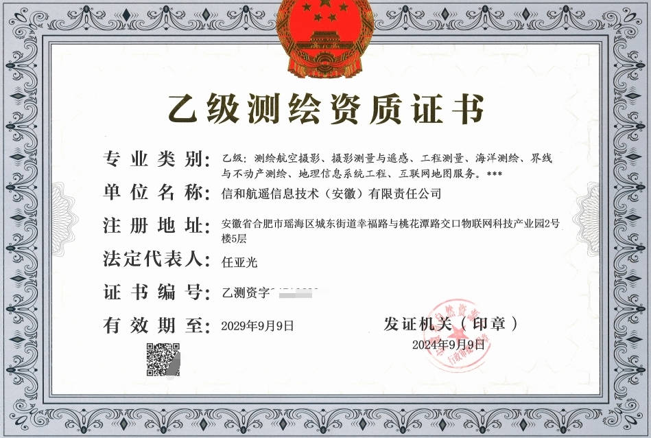
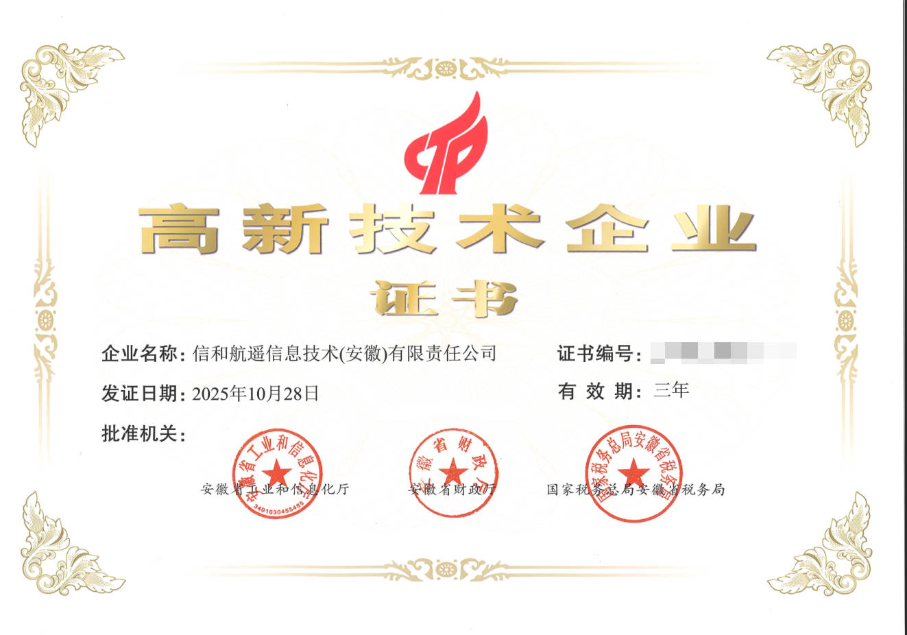
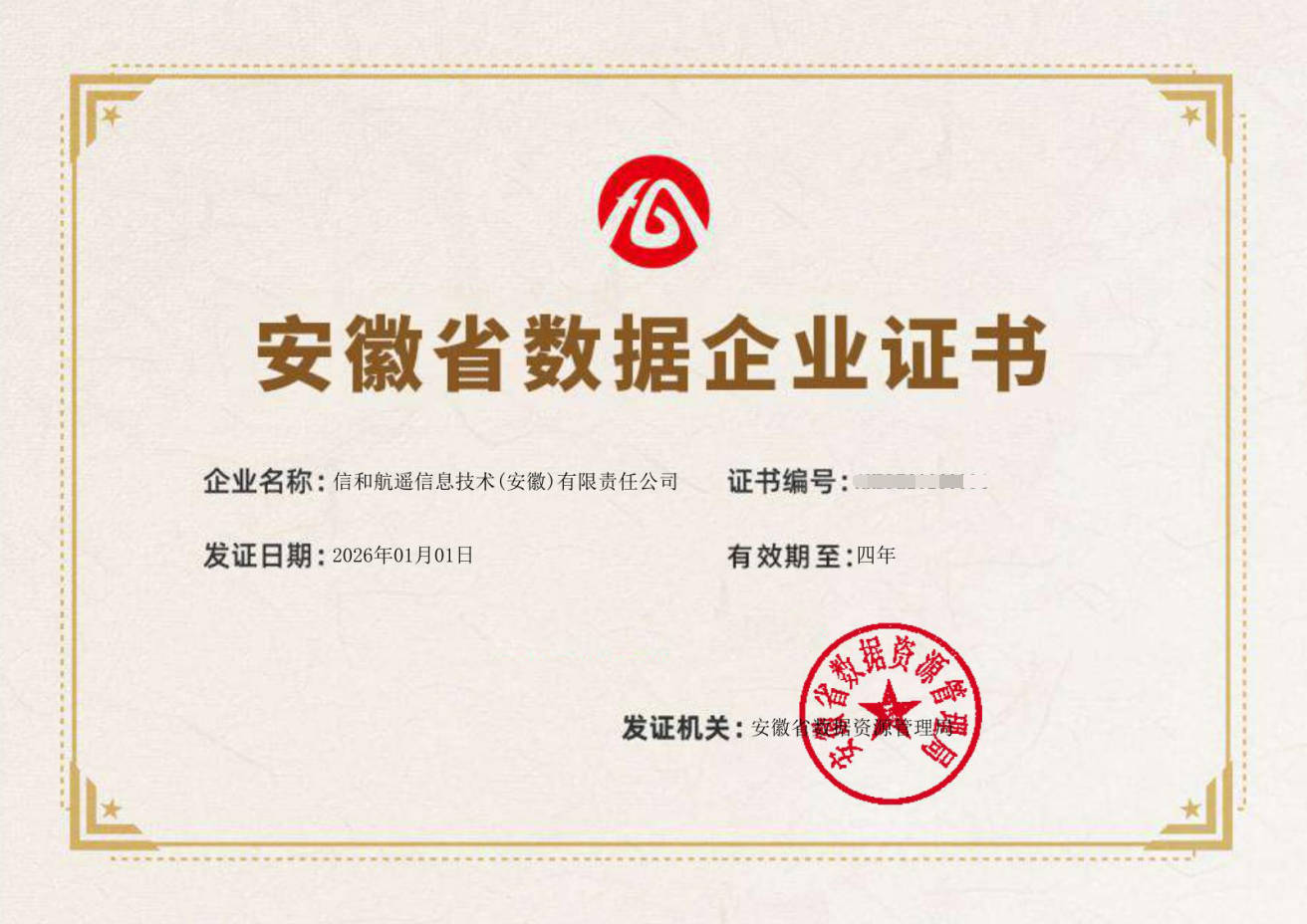
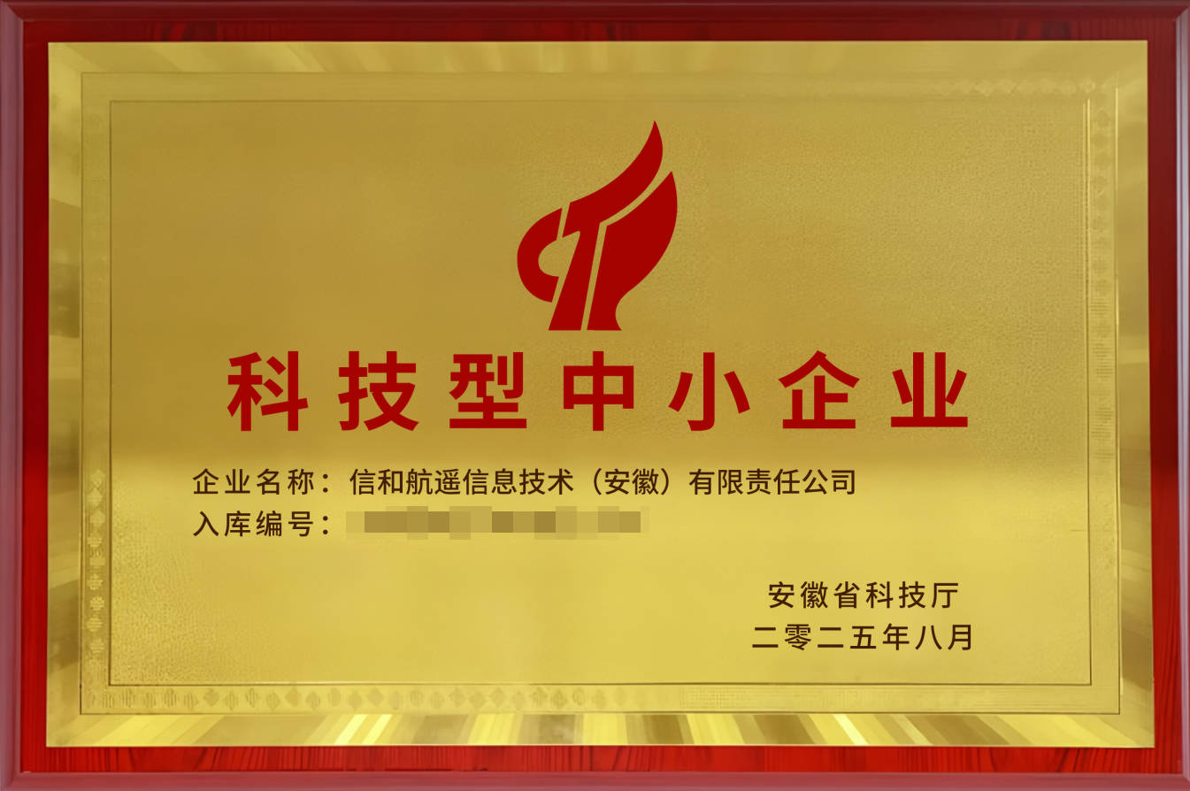
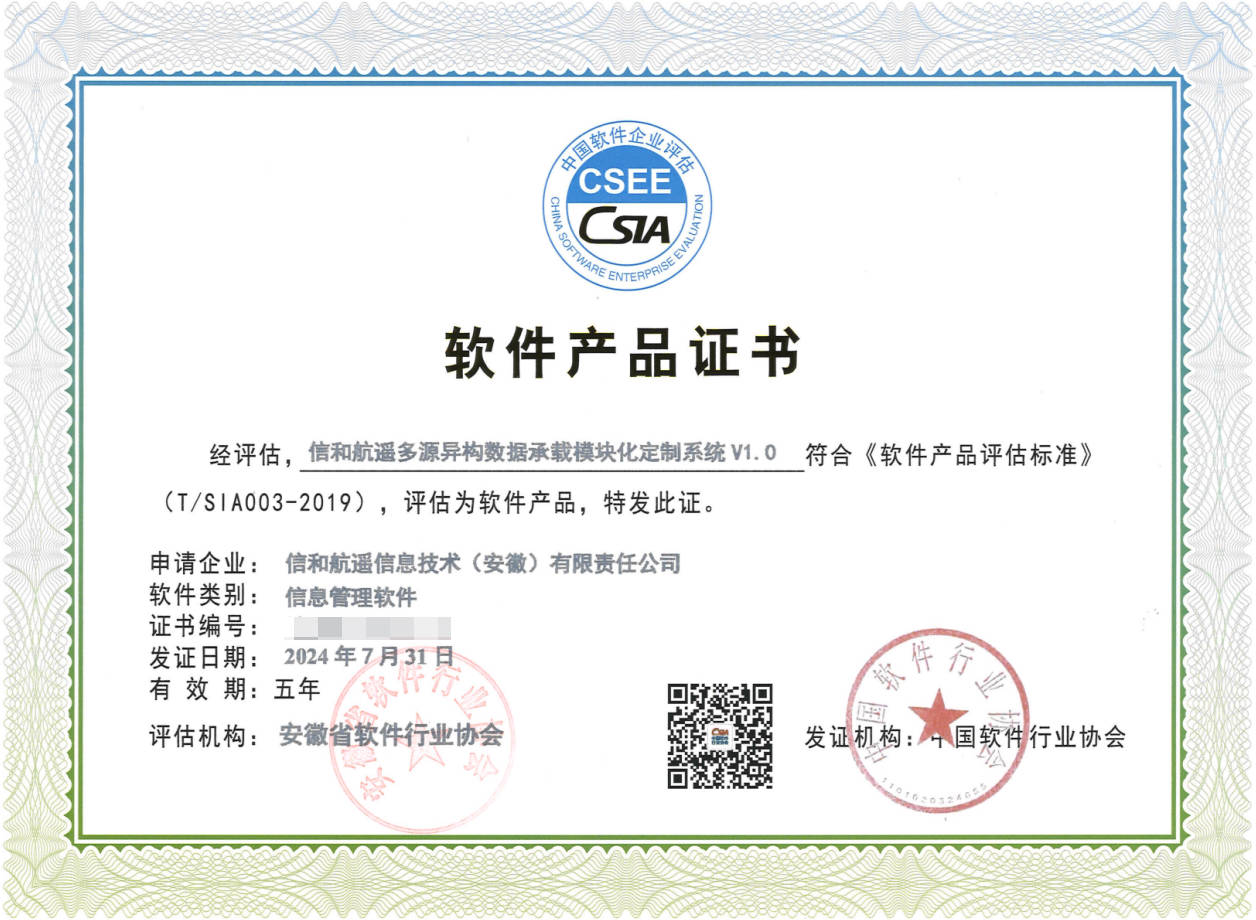
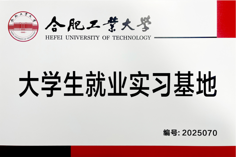
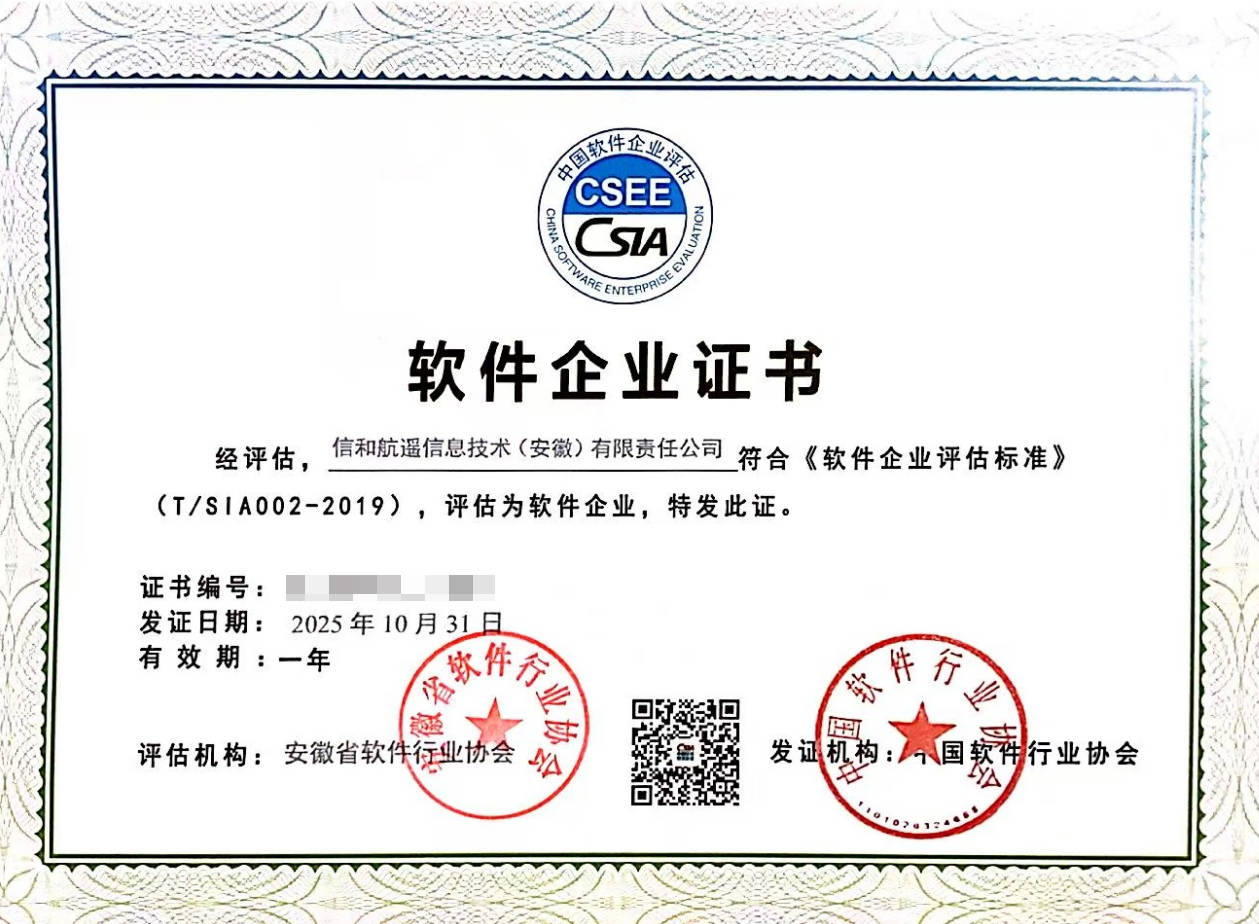
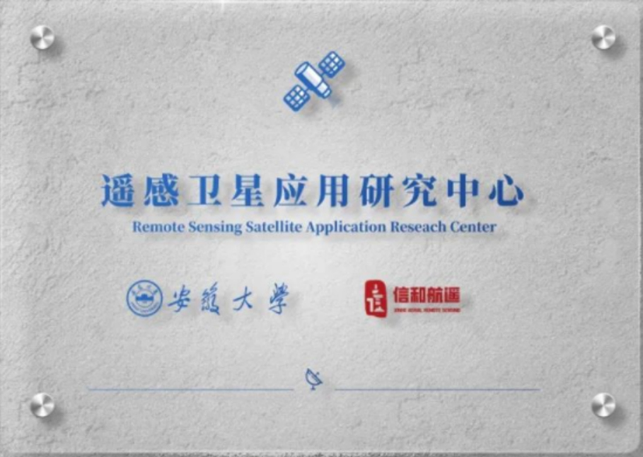
Xinhe Hangyao Information Technology (Anhui) Co., Ltd. is an enterprise mainly engaged in the promotion and application services of aerospace information technology. The company holds a surveying and mapping qualification certificate issued by the Department of Natural Resources, has passed the dual-software enterprise certification, and is a national high-tech enterprise, an Anhui provincial data industry enterprise, an Anhui provincial technology-based small and medium-sized enterprise, a key enterprise in Hefei's aerospace information industry chain, a Hefei big data enterprise, a Hefei-scale enterprise, and an excellent innovative enterprise in Yaohai District. The company has jointly established a university-enterprise practice base with Hefei University of Technology to promote the integration of industry, education and research; it has jointly established Anhui's first "Remote Sensing Satellite Application Research Center" with Anhui University to consolidate the transformation of scientific research achievements in combination with market demand.
The company's main business direction is the sky-earth integration monitoring technology service, including: satellite remote sensing data processing, production and comprehensive monitoring application services, UAV intelligent AI inspection, digital twin model production, customized development of various 3D visualization platforms, and surveying and mapping geographic information services. Its business covers national ministries and commissions, domestic provinces such as Anhui, Jiangsu, Zhejiang, and Guangxi, as well as many countries and regions such as New Zealand, the United Kingdom, Australia, and Oman.
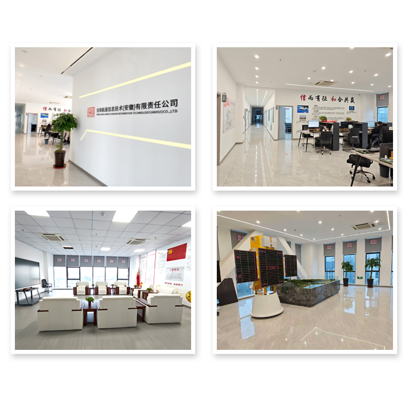
Office environment
Xinhe Hangyao has created an office space that combines a sense of technology with humanistic warmth. In the bright and transparent open office area, intelligent office equipment and data visualization screens are arranged in an orderly manner, providing efficient support for technological research and development as well as project collaboration. The independent seminar rooms and industry-university-research cooperation zones are exclusive places for brainstorming and solving technical problems.
The rest area is full of greenery, with a coffee corner and leisure sofas all available, allowing everyone to relax comfortably after a busy work. The atmosphere of open communication, mutual assistance and common progress among the team makes this place not only an office, but also a fertile ground for growth in the pursuit of dreams in the field of aerospace information.
Qualifications and Honors
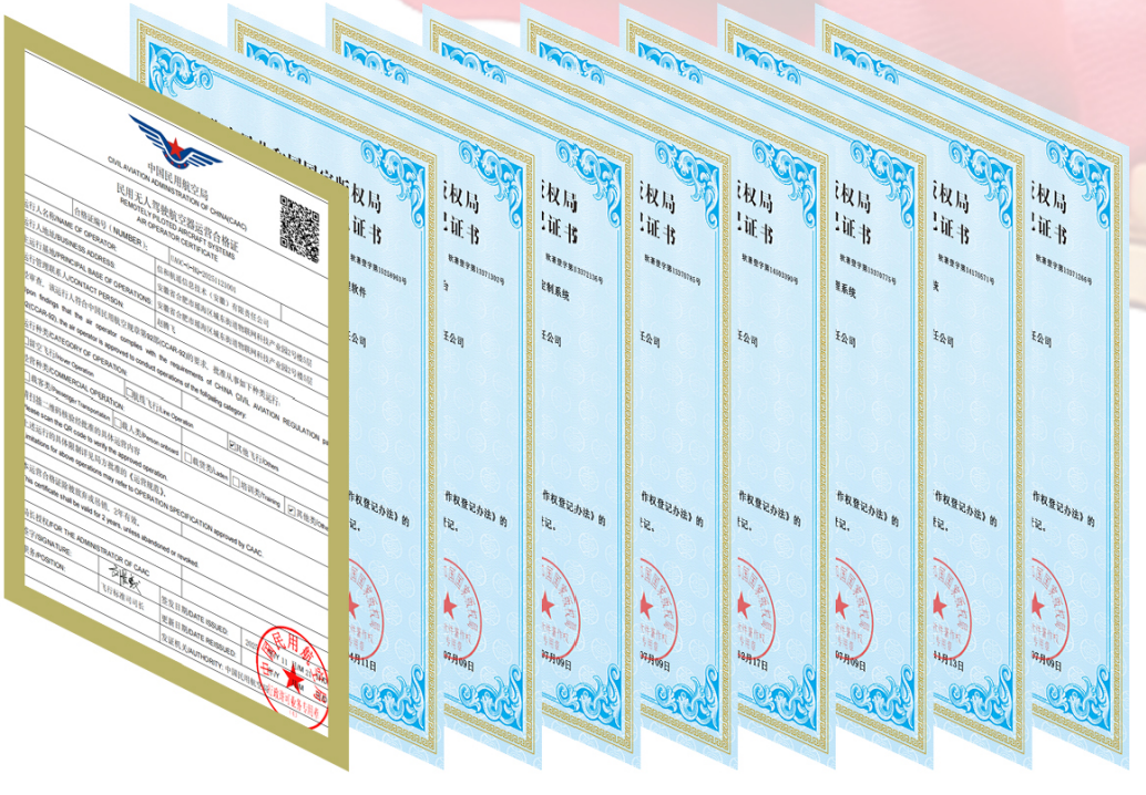
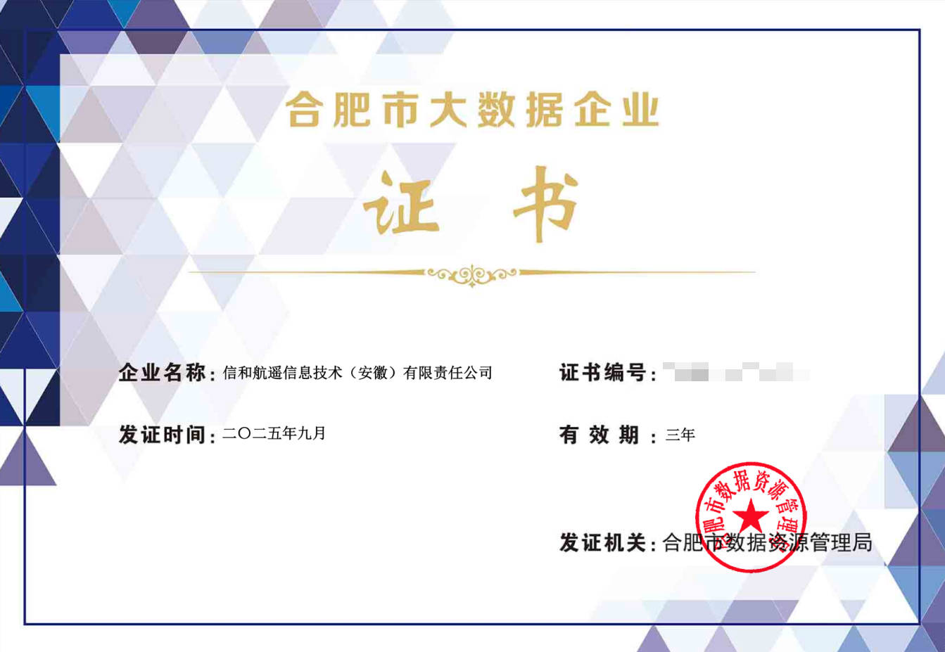
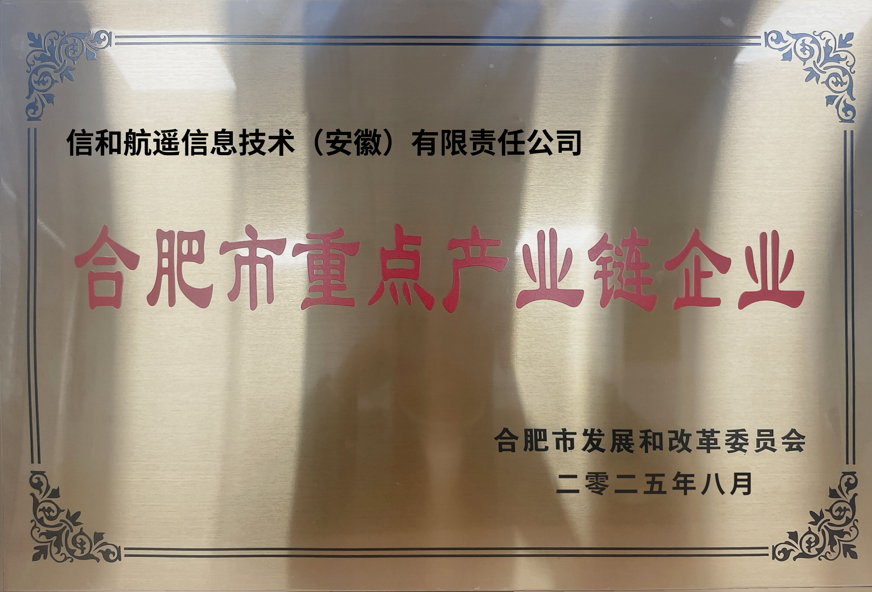
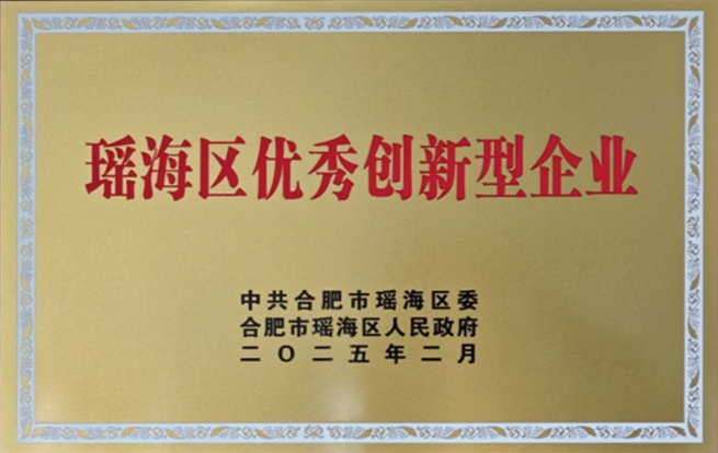
Xinhe Hangyao boasts a host of solid qualifications and authoritative honors. It not only holds the Surveying and Mapping Qualification Certificate issued by the Department of Natural Resources and has passed the dual-software enterprise certification, but also has won many important titles such as National High-Tech Enterprise, Anhui Data Enterprise, Anhui Technology-Based Small and Medium-Sized Enterprise, Key Enterprise in Hefei Aerospace Information Industry Chain, Hefei Big Data Enterprise, Hefei Above-Scale Enterprise, and Yaohai District Excellent Innovative Enterprise. At the same time, it has joined hands with Hefei University of Technology and Anhui University to build an industry-university-research platform, empowering its development with a solid foundation of qualifications.


Let's work together to create more intelligent digital achievements with greater social value.
Xinhe Hangyao not only provides technical solutions, but also is committed to becoming your long-term partner in exploring the infinite possibilities of geographic information. Take some time to communicate your ideas, and we will listen attentively here and give professional responses.