Space-Air-Ground Integration Empowers Water Conservancy | Applications of Satellite Remote Sensing and UAVs in the Water Sector
Against the backdrop where flood control security, water supply guarantee and ecological security are equally prioritized today, how can we quickly detect the "four irregularities" in rivers and lakes? How can we accurately verify the storage capacity of reservoirs? How can we dynamically track changes in water shorelines and aquatic ecology? These long-standing challenges perplexing water managers and regulators often stem from the limitations of traditional manual patrols: low frequency, numerous blind spots, and untraceable on-site records, which lead to information asymmetry, regulatory lags and frequent disputes. Satellite remote sensing and unmanned aerial vehicles (UAVs), with the three-dimensional perspective of "space-air-ground integration", are making every change to water surfaces and shorelines traceable and verifiable.
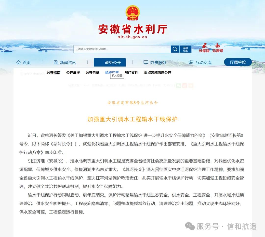
This year, the Department of Water Resources of Anhui Province explicitly launched a full investigation into 5,200 small and medium-sized reservoirs across the province, focusing on daily management irregularities that threaten reservoir operation safety, storage capacity security and bank stability. Meanwhile, the 8th General River Chief Order of Anhui Province was issued, laying out protection arrangements for major water conveyance trunk lines including the Anhui section of the Yangtze-to-Huaihe Water Diversion Project and the Northward Huaihe Water Diversion Project. The Ministry of Water Resources also clearly required full utilization of modern technologies such as satellite remote sensing, UAVs and unmanned surface vessels (USVs) to accelerate the construction of a monitoring and perception network "with satellite remote sensing as the mainstay and UAVs as the supplement".
As a national high-tech enterprise, Xinhe Aerospace Remote Sensing specializes in space-air information industry solutions. We have successfully deployed space-air-ground integrated monitoring services in projects covering the "four irregularities" monitoring of rivers and lakes in the H River Basin of Guangdong, ecological monitoring of a super-large reservoir, and reservoir storage capacity verification. In this article, we will explain how satellite remote sensing and UAVs function in these scenarios.
01 The Eye from Space: What Satellite Remote Sensing Delivers for Water Conservancy
The core strengths of satellite remote sensing boil down to three features: wide coverage, long time span and comprehensive observation. A single satellite pass covers hundreds of square kilometers, and multi-temporal imagery can reconstruct changes over months or even years. Applied to water conservancy scenarios, it undertakes four key tasks:
① Regularized monitoring of the "four irregularities" in rivers and lakes. Illegal occupation, illegal mining, illegal dumping and illegal construction are persistent pain points in river and lake management. By comparing high-resolution images, change patches such as newly built structures, illegal stockpiles and land reclamation can be quickly identified, providing targeted clues for the "four irregularities" rectification — exactly the core scenario of the "regularized intelligent monitoring via satellite remote sensing" advocated by the Ministry of Water Resources.
② Dynamic monitoring of water shorelines and aquatic ecology. Multispectral and hyperspectral imagery are used to invert water body extent and water quality parameters (such as chlorophyll-a and suspended matter concentration), and track the spatiotemporal evolution of cyanobacterial blooms and water eutrophication. Take cyanobacteria monitoring in Chaohu Lake as an example: cyanobacteria are rich in chlorophyll-a and phycocyanin, with significantly higher reflectance in the near-infrared band than clean water. Through algorithms including the Normalized Difference Vegetation Index (NDVI) and Floating Algae Index (FAI), cyanobacteria accumulation zones can be identified, and maps of bloom frequency and chlorophyll-a concentration distribution can be generated, achieving visible, accurate and trackable monitoring.
③ Monitoring of water disasters and water-related hazards. During flood events, it can rapidly provide data on inundation area and depth to support flood forecasting and emergency response. In areas without ground observation stations, satellite remote sensing is even the only monitoring method for hazards such as barrier lakes, landslides and debris flows.
④ Spatial management of water conservancy projects and rivers/lakes. It monitors the construction progress of projects, identifies hidden dangers of reservoir bank landslides, carries out safety inspections of reservoir flood discharge, and extends to scenarios such as soil erosion and ice flood monitoring.
02 The Hand from the Air: Application Scenarios of UAVs
If satellites are "wide-angle lenses", UAVs are "microscopes" — flexible, efficient, and compatible with multiple sensors, perfectly bridging the "last mile" from satellite detection to on-site verification:
① Intelligent patrol inspection: UAVs conduct automatic patrols along pre-planned routes, and timely report issues such as damaged water-related structures and floating debris on water surfaces. Combined with drone ports, they enable periodic project inspections and automatic data return & archiving, greatly improving service continuity.
② Water quality monitoring: Equipped with multispectral imagers, water quality samplers and other devices, UAVs carry out all-round inspections of rivers and lakes, generate real-time water quality imagery, and help locate pollution sources and assess pollution levels.
③ Water conservancy law enforcement: UAVs efficiently perform river and lake patrols, quickly locate and record illegal sand mining, shoreline encroachment and other violations, and solidify evidence for law enforcement authorities.
④ Reservoir inspection and storage capacity calculation: UAVs conduct refined inspections of dam bodies, reservoir perimeters and water surfaces to warn of potential safety hazards. Equipped with multiple sensors and combined with underwater measurement by unmanned surface vessels, they can complete reservoir storage capacity verification and inundation area analysis.
⑤ Surveying and emergency response: High-precision aerial survey data is used to build digital models, supporting water conservancy engineering design, construction progress supervision and project acceptance. In emergencies such as dam breaches and flash floods, UAVs can quickly reach the scene and provide first-hand disaster information.
03 Three Real Cases: From Capability to Delivery
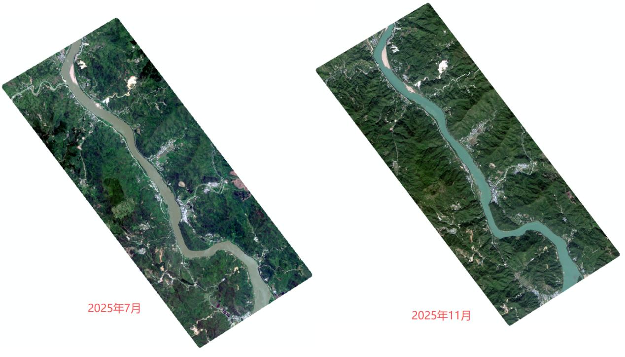
Case 1 | "Four Irregularities" Monitoring in a Basin of H River, Guangdong
Task: Conduct special monitoring of the "four irregularities" (illegal occupation, illegal mining, illegal dumping, illegal construction) in a basin of H River, and identify the full inventory of violation patches.
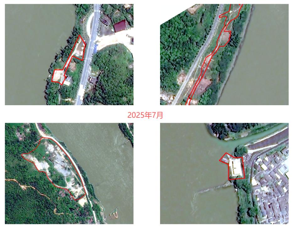
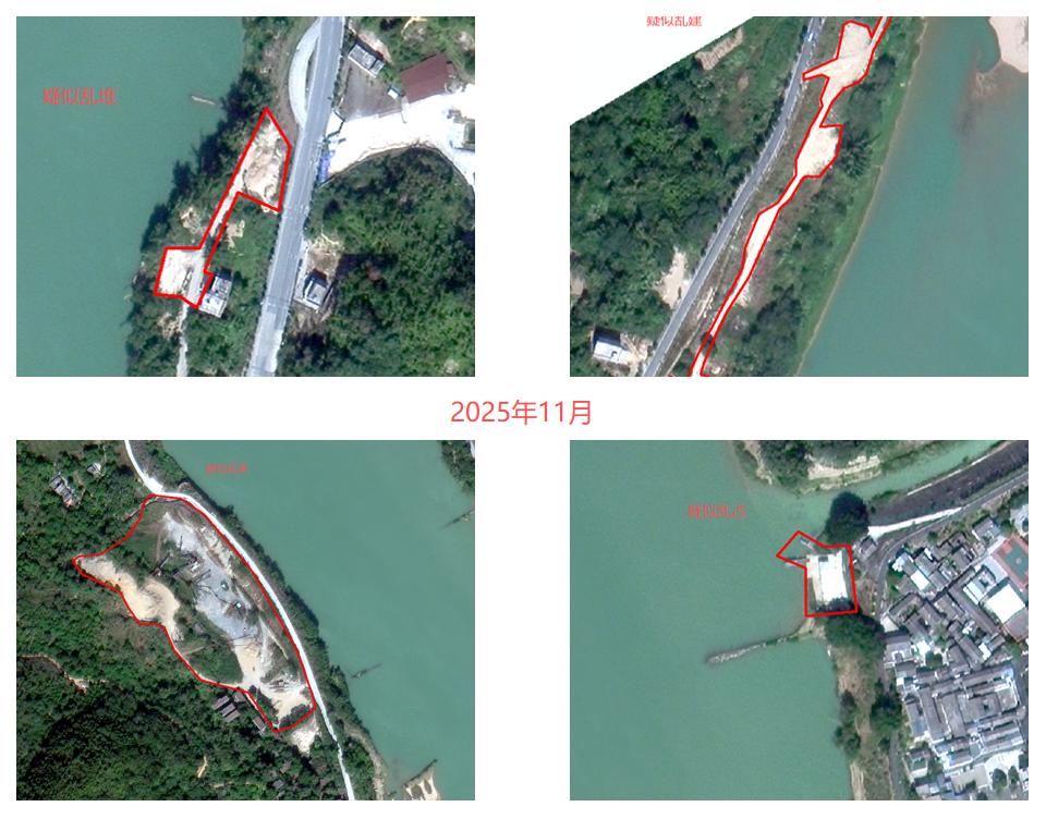
Approach: Adopt high-resolution satellite remote sensing imagery for full-coverage investigation of the basin. Taking two phases of imagery from July 2025 and November 2025 as samples, temporal comparison was performed to identify change patches.
Outcome: Suspected illegal patches including newly built structures, land reclamation and waste dumps were accurately located and mapped, providing visual evidence support for the local authority's workflow of "detection – assessment – disposal – closure".
Case 2 | Ecological Monitoring of a Super-Large Reservoir
Task: Focusing on reservoir ecological security, carry out dynamic monitoring in four dimensions: new building monitoring in the reservoir area, dynamic monitoring of reservoir water boundaries, land use analysis around the reservoir, and drought & inundation analysis around the reservoir.
Approach: Superimpose and compare multi-temporal satellite remote sensing images, combining remote sensing interpretation with on-site verification.
Outcome: Suspected change patches such as newly added reclamation bodies, stockpiles and roads were quickly identified, and changes in water boundaries and surrounding land use were dynamically tracked, providing a data foundation for reservoir management and aquatic ecological protection.
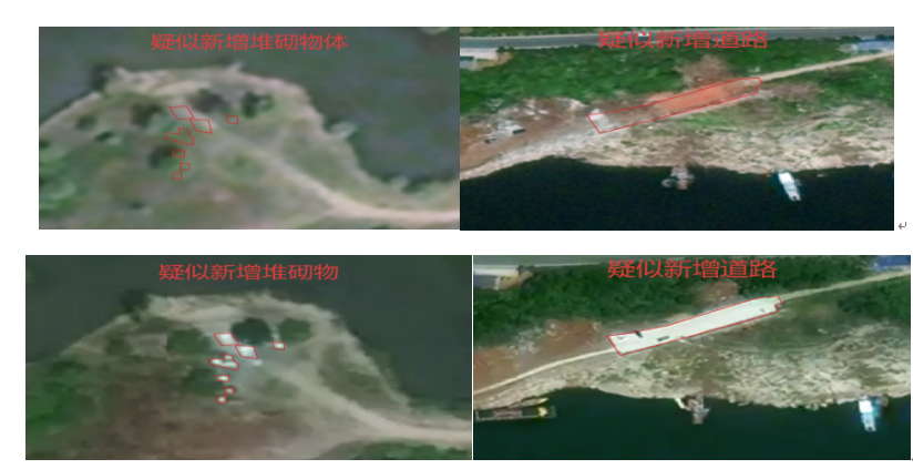
Monitoring of Newly Constructed Buildings in Reservoir Areas
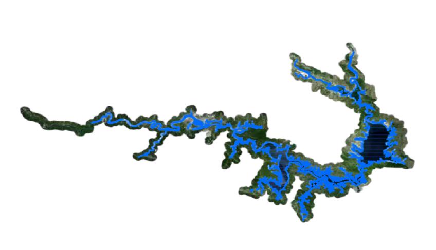
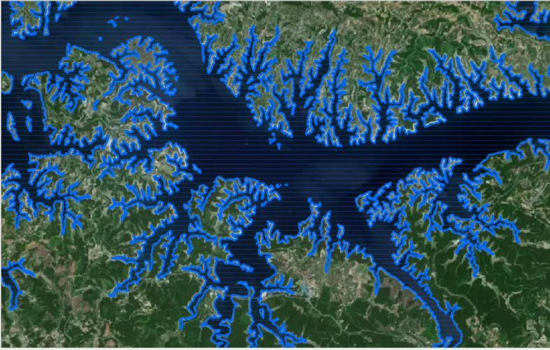
Dynamic Monitoring of Water Body Boundary in Reservoir Areas
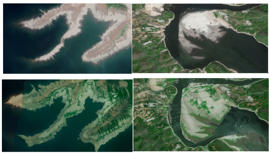
Imagery Analysis of Drought and Inundation Around Reservoirs
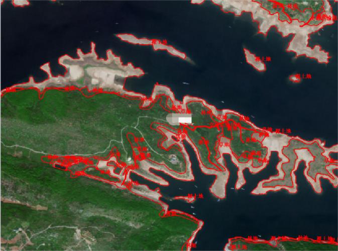
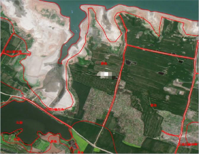
Analysis of Land Use Status Around Reservoirs
Case 3 | Reservoir Storage Capacity Verification
Task: Carry out reservoir storage capacity verification and inundation area analysis to clarify the full "profile" of the reservoir.
Approach: UAVs equipped with multiple sensors acquire above-water topography and imagery, while unmanned surface vessels carry depth-measuring equipment for underwater surveys, realizing "one unified map above water, one unified map underwater".
Outcome: Water level-storage capacity curve and water level-surface area curve are generated, superimposed with the dead water level line, normal storage level line and check flood level line. The reservoir area elevation model and topographic map are delivered, providing accurate basis for storage capacity safety management and flood control dispatch.
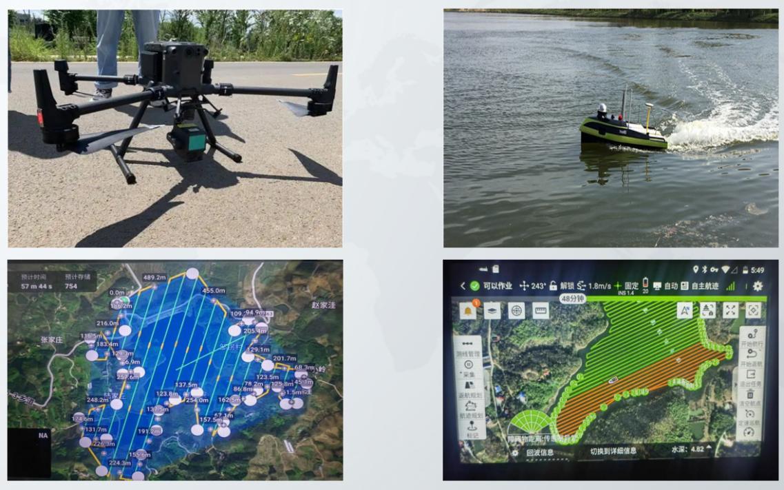
UAVs and Unmanned Surface Vessels for Reservoir Storage Capacity Verification
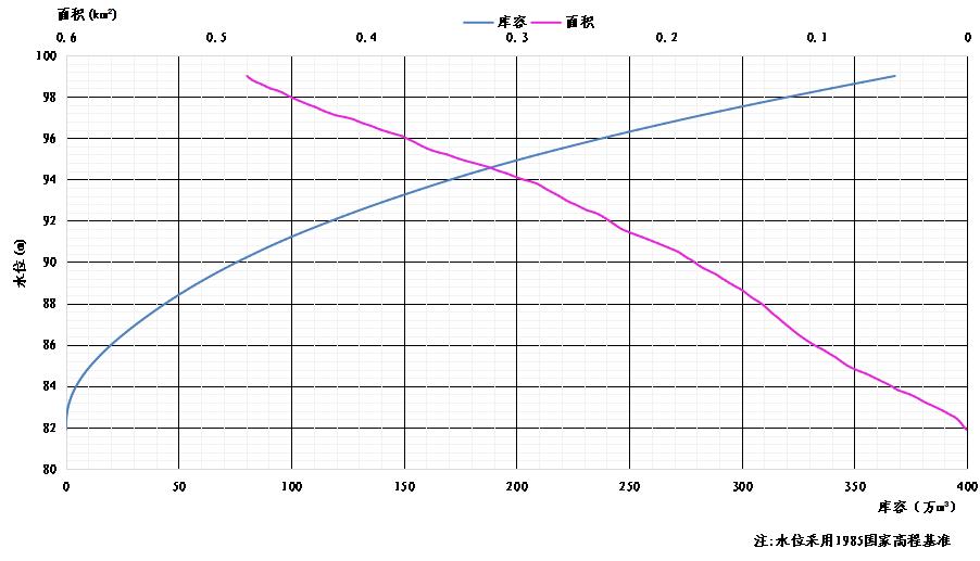
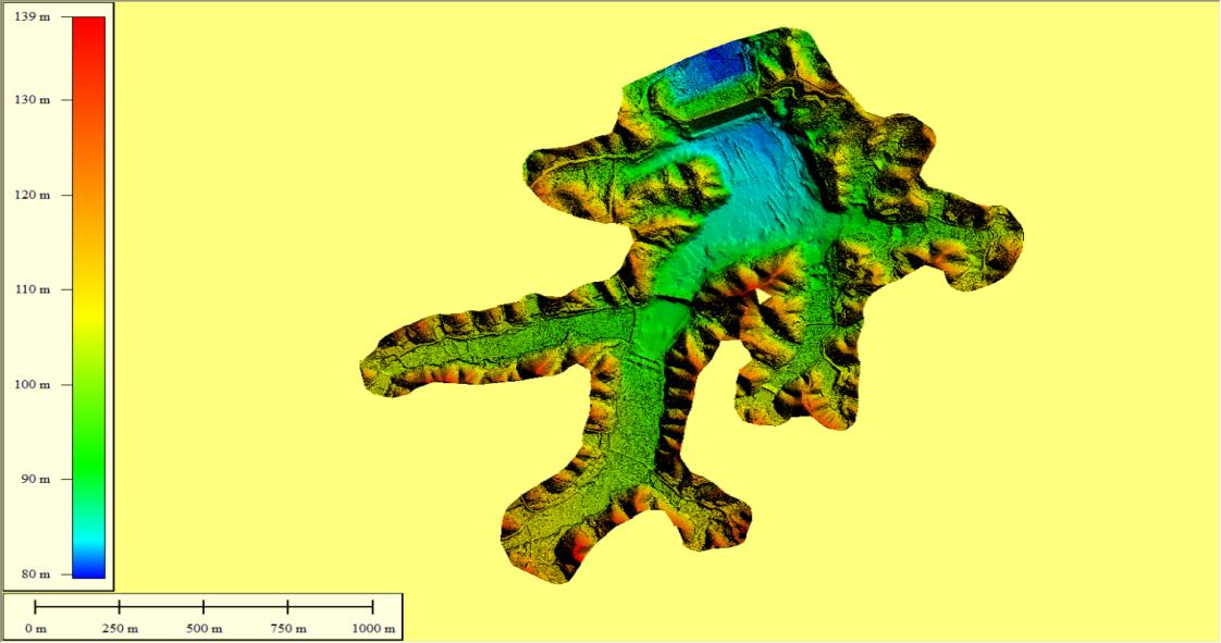
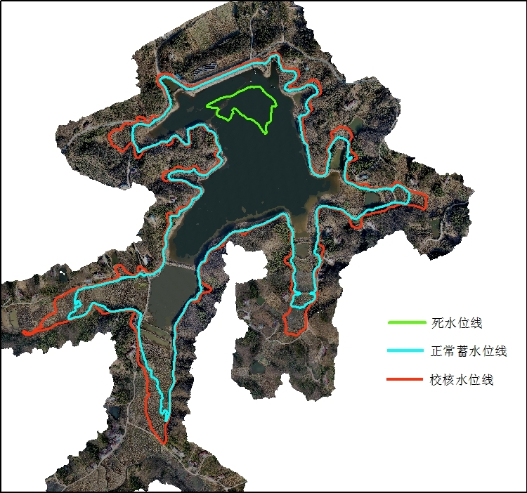
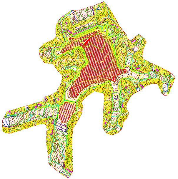
Series of Result Figures for Reservoir Storage Capacity Verification
04 Conclusion: Making Space-Air-Ground Integration the New Normal of Water Governance
From "labor-intensive manual patrols" to "data-driven management", water governance is undergoing a profound transformation. With satellites overlooking from space, UAVs inspecting closely from the air, and unmanned vessels measuring underwater, space-air-ground integrated monitoring is making every river and reservoir visible, measurable and manageable.
In this transformation, Xinhe Aerospace Remote Sensing is committed to building a space-air-ground integrated monitoring service system featuring "satellite remote sensing + UAV + unmanned surface vessel + ground equipment + digital twin", so that every water governance decision is evidence-based, image-supported and data-driven.
If you are also facing water conservancy challenges such as "four irregularities" investigation, reservoir storage capacity verification, water shoreline monitoring or aquatic ecological protection, welcome to contact us.
Let every change be traceable, let every water area be well understood — Xinhe Aerospace Remote Sensing, ready to guard rivers and lakes together with you.