-- In-depth interpretation of the " 14th Five-Year Plan" for Ecological Environment Monitoring
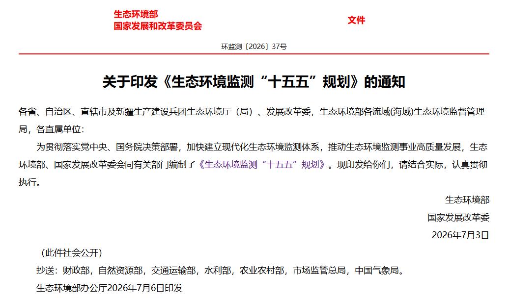
Recently, the Ministry of Ecology and Environment and the National Development and Reform Commission jointly issued the " 14th Five-Year Plan for Ecological Environment Monitoring", which clarifies that by 2030, a modern ecological environment monitoring system will be basically established, with the integration of space, land, and sea monitoring and digital and intelligent transformation as the main line, covering five major areas: monitoring network, business support, quality management, technical equipment, and basic capabilities.
For geospatial information technology enterprises that specialize in satellite remote sensing, drone inspection, and digital twins, this "Planning" has unlocked the full-chain market potential. Leveraging our own technology matrix, we have identified five core application tracks.
I.Build a solid perception foundation: support the establishment of an integrated monitoring network for the sky, land, and sea
The "Plan" proposes to basically establish an integrated ecological environment monitoring network covering the sky, land, and sea, and to promote the construction of satellite networking and low-altitude monitoring networks, as well as the interconnection between central and local networks. This is precisely the core application scenario of the integrated sky-land technology.
Satellite remote sensing: the core carrier for global macro-monitoring
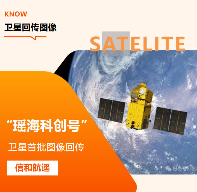
Relying on the series of environmental disaster mitigation satellites, carbon satellites, and high-resolution optical remote sensing satellites, we can support national and provincial ecological quality baseline surveys, macro-monitoring of key river basins, and dynamic optimization of monitoring networks. Our company possesses over 170 on-orbit satellite resources, and the first commercial optical remote sensing satellite in Anhui Province (with a resolution better than 0.5m), which was jointly developed by us, has been successfully launched. This satellite can support the goal of "increasing the remote sensing monitoring capacity of human activities in important ecological spaces to 1 million square kilometers per month" as outlined in the "Plan".
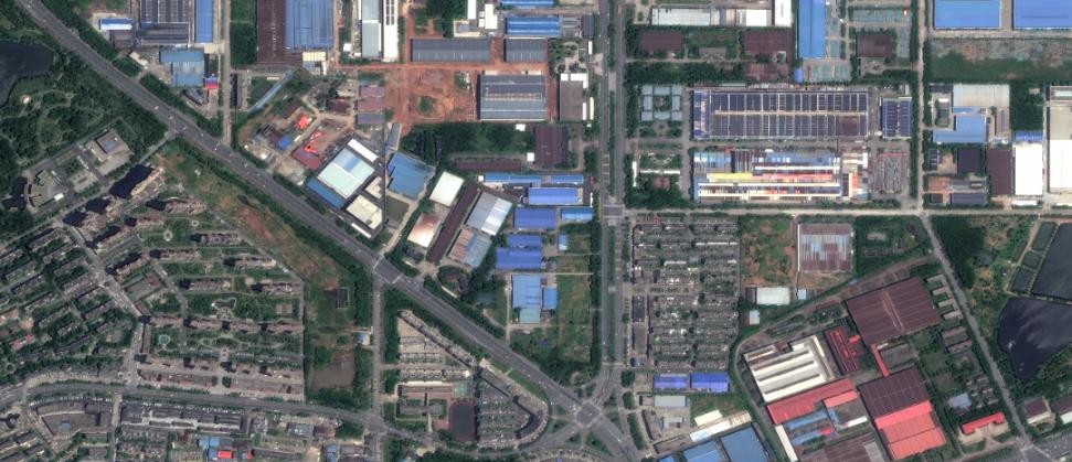
Satellite imagery with a resolution of 0.5 meters
Drone inspection: a crucial blind spot filling method for low-altitude monitoring networks
Drones can bridge the monitoring gap between satellites and ground stations, conducting centimeter-level high-frequency inspections for scenarios such as districts and counties, towns and townships, tributary river systems, sewage outlets, industrial parks, and core areas of nature reserves. Our company's self-developed smart inspection system, equipped with an AI recognition model, effectively addresses the pain points of satellite obstruction by clouds and fog, as well as insufficient coverage by ground stations.
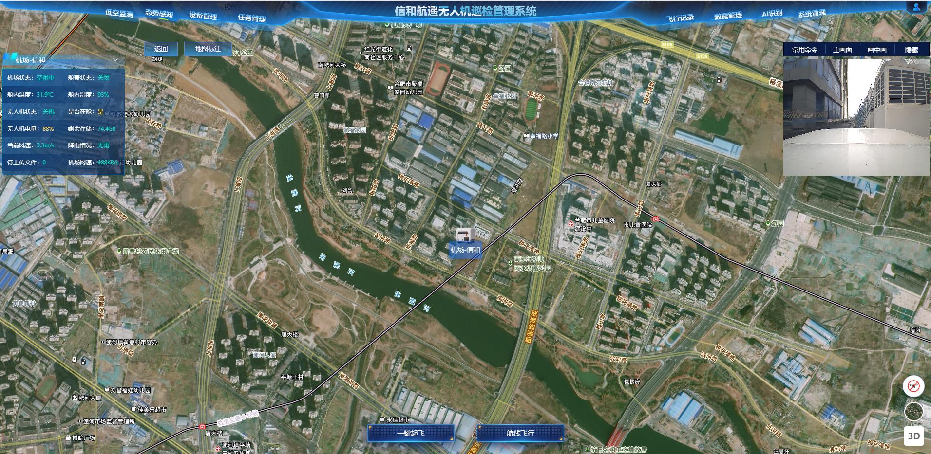
Xinhe Hangyao UAV Inspection Management System
Ground monitoring collaboration: Establishing a three-tier data calibration system
Integrate data from ground stations and mobile monitoring equipment to form a three-level calibration system of "space-based macro observation - air-based meso-inspection - ground-based precise sampling", achieve cross-validation of multi-source data, and facilitate the construction of a unified operation and control platform for provincial monitoring networks.
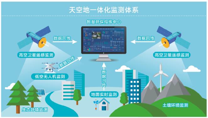
Integrated sky-ground monitoring system
II. Deepening ecological protection: Empowering precise supervision of ecological quality and biodiversity
The "Plan" prioritizes ecological protection and restoration monitoring, explicitly requiring the enhancement of ecological quality evaluation capabilities, the promotion of biodiversity monitoring, and the conduct of dynamic assessments on the effectiveness of ecological restoration.
Remote sensing assessment of large-scale ecological quality
Through long-term satellite remote sensing data, we conduct monitoring of ecosystem patterns, quality, and functions across the country and key regions. For the ecological barrier areas of the Qinghai-Tibet Plateau and key ecological zones of the Yangtze River and Yellow River, we implement dynamic early warning for ecological security risks such as glacier melting and permafrost degradation. We also conduct continuous tracking and monitoring of coal mining subsidence areas and mine restoration areas to quantitatively assess the effectiveness of restoration.
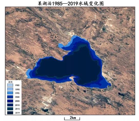
Time-series remote sensing monitoring of a certain lake
Fine-grained verification of biodiversity and human activities
In priority areas for biodiversity conservation, ecological corridors, and migratory routes for migratory birds, drones equipped with infrared cameras, lidar, and other payloads can conduct habitat patrols and ecological surveys. For remote sensing patches of human activities in nature reserves, drone-based on-site verification can help achieve the goal of "monthly full coverage of remote sensing of human activities in national nature reserves, with an accuracy rate of 85% for patch identification".
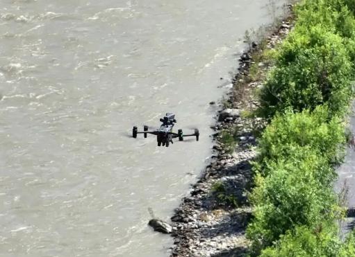
Inspection in drone protection zone
Digital Twin 3D Visualization and Management
Build a digital twin 3D base for key ecological regions, integrate multi-dimensional data such as ecosystem types, species distribution, and human activities, and achieve 3D visualization, dynamic simulation, and risk early warning of ecological conditions, providing decision support for ecological protection, restoration, and supervision.
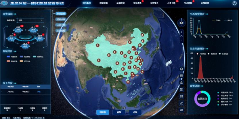
Integrated smart supervision system for ecological environment
III. Assisting in pollution control: supporting penetrating supervision of pollution sources and precise pollution control
Deepening the fight to protect the blue sky, clear water, and clean soil is the core demand of ecological monitoring. The "Plan" puts forward more refined and intelligent requirements for monitoring in the fields of air, water, soil, and solid waste.
Satellite remote sensing: large-scale pollution investigation and source tracing
Carry out remote sensing monitoring of regional air quality and watershed water quality to support pollution transmission analysis and source tracing and judgment; establish a full-process automated interpretation system for illegal dumping of solid waste to support the task goal of "annual remote sensing monitoring coverage of over 2 million square kilometers for solid waste"; simultaneously carry out remote sensing monitoring of soil heavy metal deposition, black soil, and saline-alkali soil environments.
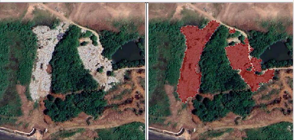
Remote sensing monitoring of solid waste
Drone inspection: precise investigation of key pollution scenarios
For scenarios such as sewage outlets into rivers and seas, industrial pollution sources, agricultural non-point sources, and black and odorous water bodies, carry out regular drone inspections to accurately locate sewage outlets and investigate pollution hazards; conduct aerial inspections of solid waste storage and disposal facilities and key enterprise parks to enhance the ability to discover and trace pollution issues.
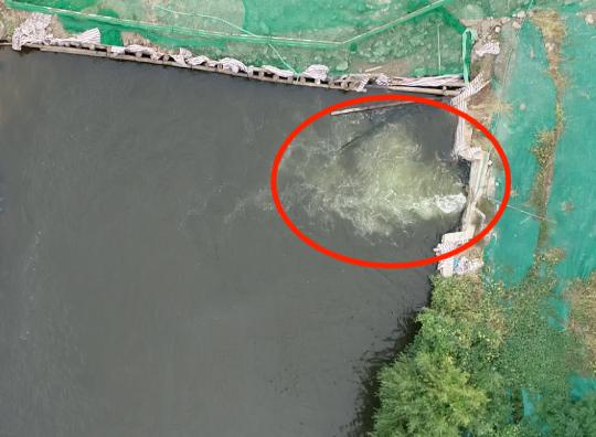
Drone monitoring of sewage outlets
IV. Layout of emerging tracks: serving the construction of dual-carbon and new pollutant monitoring system
Addressing climate change and managing new pollutants are emerging key areas of ecological monitoring in the 14th Five-Year Plan period, and also represent growth sectors for the expanded application of remote sensing technology.
Support for multi-scale monitoring of greenhouse gases
Relying on carbon satellite and hyperspectral satellite data, we conduct regional greenhouse gas column concentration inversion and emission accounting. Combined with drone-mounted monitoring equipment, we carry out detailed carbon emission verification for industrial parks and key urban areas. We also serve in the construction of a multi-scale greenhouse gas monitoring network spanning "global-national-regional" levels.
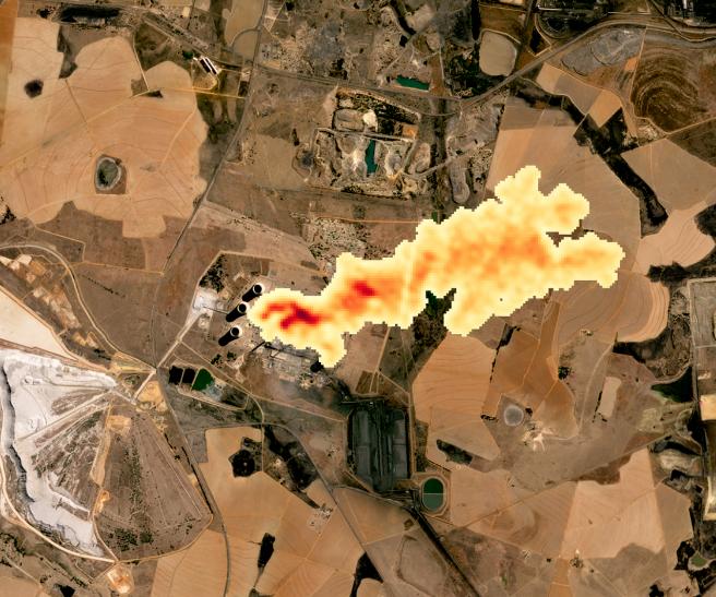
Satellite monitoring of carbon dioxide plume
Spatial analysis and assessment of new pollutant monitoring
Utilize remote sensing to identify the spatial distribution of key industry enterprises and industrial parks, and assist in the optimal layout of new pollutant monitoring sites; combine drone sampling with ground data to construct an environmental risk spatial assessment model, supporting risk assessment of new pollutants in typical areas.
V. Accelerating digital and intelligent upgrading: Building a three-dimensional digital base for smart monitoring
The "Plan" regards digital and intelligent transformation as the main development thread, explicitly proposing to advance core tasks such as the research and development of large monitoring models, intelligent interpretation of remote sensing data, and the construction of intelligent operation and control platforms.
The implementation of remote sensing intelligent interpretation technology
Based on deep learning algorithms, we have developed an automated processing and intelligent interpretation system for multi-source satellite data, achieving automated high-precision processing of land feature classification, target recognition, and change detection, supporting the goal of "localizing over 90% of important ecological parameter remote sensing products domestically".
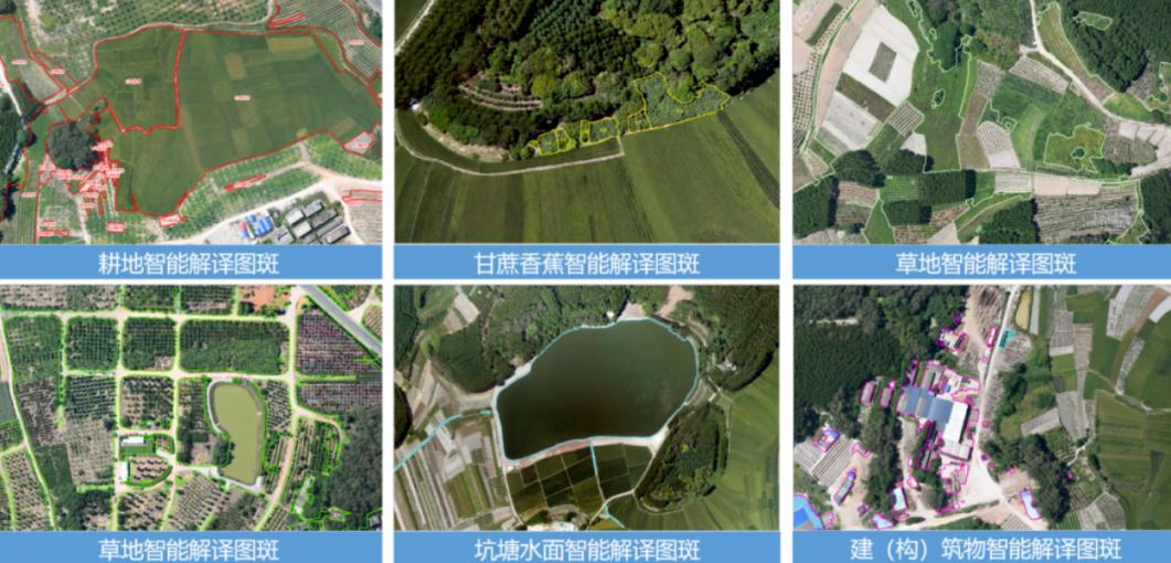
Remote sensing intelligent interpretation
Digital Twin Smart Operation and Control Platform
Construct digital twin 3D models at scales such as cities, river basins, and industrial parks, integrate multi-source data from the sky, land, and sea, and create a "one-map" type intelligent monitoring and operation control platform. This platform enables unified site scheduling, 3D visualization of pollution trends, prediction and early warning simulation, and matches the local implementation needs of the " 1+7+N" national monitoring network management mechanism.
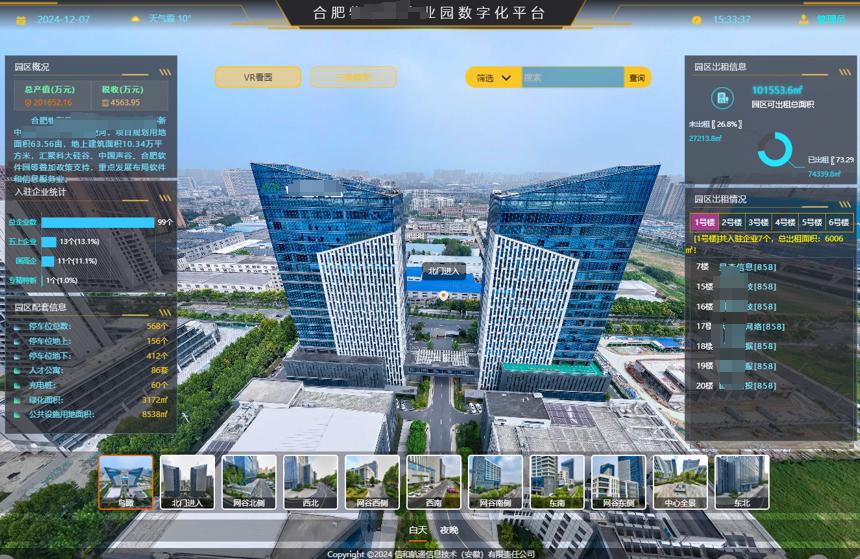
Digital park platform
Full-stack localization adaptation
Focusing on the requirement stated in the "Plan" that "mainstream monitoring equipment should be essentially autonomous and controllable", we will adapt domestic satellites and domestic software and hardware environments to create a full-stack, domestically-developed remote sensing monitoring and 3D visualization solution, ensuring data security and autonomous control of the technology supply chain.
Conclusion
The "15th Five-Year Plan" is a crucial five-year period for the transformation and upgrading of the ecological environment monitoring system, with clear industry directions of sky-ground integration, digitalization and localization. Xinhe Aerospace Remote Sensing will closely adhere to the requirements of the "Plan", with satellite remote sensing as the core, drone and ground monitoring as support, and digital twins as the carrier, to deeply participate in the construction of national and local monitoring networks, inject technological momentum into the construction of a modern ecological environment monitoring system, and help achieve the goal of building a beautiful China!