信和航遥
信和航遥信息技术 (安徽) 有限责任公司,专注空天信息科技推广与应用服务,主营天空地一体化监测技术服务。
professional
Integrate multi-source data such as satellite remote sensing, unmanned aerial vehicles, etc., with intelligent algorithms, and define new monitoring standards with leading technologies.
team
Gather outstanding talents in the fields of photogrammetry, geographic information, and computer vision, collaborate for innovation, and intelligently inspire the future.
enthusiasm
With the mission of exploring sky-ground integration monitoring, we drive every precise insight with passionate service.
Precise data definition, wisdom measures the world
We are a leading provider of integrated space-air-ground intelligent monitoring solutions. By integrating satellite remote sensing, unmanned aerial vehicles (UAVs), and Internet of Things (IoT) sensing, we offer customers comprehensive, real-time, and accurate spatiotemporal data along with in-depth insights to empower intelligent decision-making.
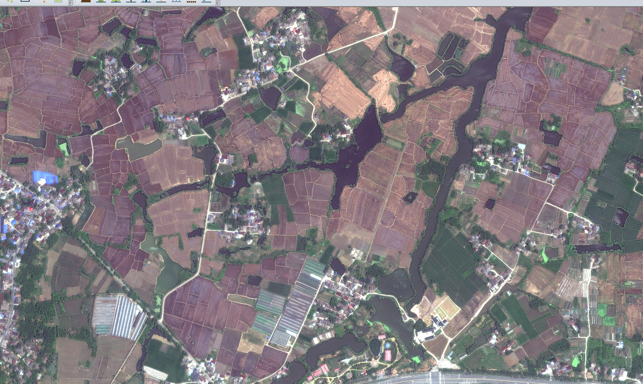
The "space-air-ground integration" monitoring comprehensively utilizes three major means: space-based (remote sensing satellites), air-based (UAVs and UAV airports), and ground-based (ground sensors and IoT devices) to build an all-round, all-weather, and high-precision three-dimensional monitoring network. These three means collaborate and complement each other's advantages, forming a complete closed loop of "macro control, medium-level detailed inspection, and micro-level display". Through "observation from the sky, inspection from the air, and management on the ground", it truly achieves "full coverage in observation, accuracy in inspection, and effectiveness in management".
From the starry sky to the surface of the earth,
Make geographic information within easy reach,
Xinhe Hangyao has built a three-dimensional perception network spanning "space, air, and ground". Looking upward, we overlook mountains and rivers with forward-looking satellite remote sensing technology, capturing global dynamics from a sub-meter perspective; rooting downward, we penetrate the subtle changes over time and space through intelligent drone inspections and ground Internet of Things sensing and transmission. Through our self-developed multi-source heterogeneous data infrastructure, we transform the vast amount of data into intuitive and accurate digital twin images, breaking down data barriers. Whether in deep mountains and dense forests or in urban streets, geographic information is no longer a cold technical coordinate but an accessible and decision-enabling intelligent force.
Looking from the sky:
Relying on sub-meter remote sensing satellites, we can achieve macro-control and precise perception from a global perspective.
Aerial inspection:
Utilize intelligent drones for inspection to capture high-dynamic and high-resolution detailed images.
Ground pipe:
Integrate IoT sensing and transmission data to bridge the "last mile" between digital and intelligent governance and closed-loop management.
Building a full-time-domain spatial big data infrastructure
Integrating satellite remote sensing, low-altitude unmanned aerial vehicle (UAV) and ground Internet of Things (IoT) sensing technologies, Xinhe Hangyao provides full-chain services from raw data collection to in-depth AI analysis, enabling the "macro control, meso detailed investigation, and micro display" of geographic information.
Yami, 0.5-meter and sub-0.5-meter satellite images/stereo image pairs/DEM/DOM data, and UAV high-definition intelligent inspection services
7*24 all-weather real-time monitoring and response capabilities provide timeliness guarantees for decision-making.
data-driven,
Reshape the new model of industry regulation
Relying on satellite remote sensing, unmanned aerial vehicle inspections, and ground sensor networks, we integrate multi-source data to build a sky-ground integrated monitoring system. Through digital twin technology, we achieve three-dimensional visual management, reshape new models of industry supervision driven by data, assist government and enterprise customers in realizing the digital and intelligent transformation from "passive response" to "active prevention", and empower precise, efficient, and intelligent overall domain governance.
Full-stack technical development capability
Intelligent Algorithms and Data Analysis
Expert in multivariate data fusion
One-stop solution
信而有征,和合共赢
Xinhe Hangyao Information Technology (Anhui) Co., Ltd. has always adhered to the core values of "credible with evidence, harmonious and win-win", and adhered to the purpose of "core technology + ultimate service". It is rooted in the field of aerospace information technology and provides high-quality technical services for the majority of owner units and partners.